1
Ysgol Gyfun Gymraeg Plasmawr, Cardiff
Viewed across Waterhall Road. The Welsh-language secondary school occupies a large site on the corner of Waterhall Road and Pentrebane Road.
Image: © Jaggery
Taken: 9 Jan 2014
0.06 miles
2
Meadowbank Court, Cardiff
Flats alongside (and slightly below) Waterhall Road.
Image: © Jaggery
Taken: 5 Mar 2015
0.09 miles
3
Queen Elizabeth II pillarbox in Keyston Road, Cardiff
Near the corner of Waterhall Road. Wikipedia states that there was no standard pillarbox colour until 1859, when bronze green became standard. That colour was chosen because it was thought that it would be unobtrusive. Too unobtrusive, as it turned out: people kept walking into them. Red became the standard colour in 1874, although ten more years elapsed before every box in the UK had been repainted.
This shade of red is now so familiar that it has an entry in Chambers Dictionary:
pillar-box red (noun) the traditional bright-red colour of British pillar boxes (also adjective).
Image: © Jaggery
Taken: 5 Mar 2015
0.10 miles
4
Former railway line towards Llantrisant in Pentrebane
Image: © Gareth James
Taken: 27 Sep 2010
0.11 miles
5
Meadowbank Court, Cardiff
Flats alongside Waterhall Road.
Image: © Jaggery
Taken: 9 Jan 2014
0.11 miles
6
Waterhall Youth Centre, Fairwater, Cardiff
The youth centre is the single-storey blue building located on the corner of Waterhall Road and Pentrebane Road in the grounds of Ysgol Gyfun Gymraeg Plasmawr. Built in the 1960s, the youth centre building is also a venue for many local community groups.
Image: © Jaggery
Taken: 9 Jan 2014
0.12 miles
7
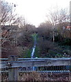
Route of a dismantled railway, Cardiff
Looking west from Waterhall Road near the corner of Ashdene Close.
A 1940s map shows a railway line through what was then a rural area between Fairwater and Radyr.
Image: © Jaggery
Taken: 9 Jan 2014
0.12 miles
8
Cosheston Road, Fairwater, Cardiff
Viewed from Keyston Road.
Image: © Jaggery
Taken: 9 Jan 2014
0.12 miles
9
Keyston Road, Fairwater, Cardiff
Viewed from the Waterhall Road end.
Keyston Road is on a bus route to and from Cardiff city centre. A bus stop pole is behind the tree.
Image: © Jaggery
Taken: 5 Mar 2015
0.13 miles
10
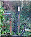
?75 fine for dog fouling in Fairwater, Cardiff
Viewed from Waterhall Road. How are the owners of fouling dogs along this secluded track caught?
Are there CCTV cameras along the path? Or a dog warden? Unlikely...
Image: © Jaggery
Taken: 9 Jan 2014
0.13 miles


