1
Clos-y-Nant main entrance, Fairwater, Cardiff
A path lined by red railings leads to the main entrance of Clos-y-Nant, one of Cardiff Council's Older Persons Accommodation sites. The accommodation is designed to cater for the needs of tenants aged at least 60. Tenants should be able to live independently in their own flats, though they may arrange their own additional help (such as cleaning or personal care) if necessary.
Image: © Jaggery
Taken: 9 Jan 2014
0.01 miles
2
Fairwater Social & Athletic Club, Cardiff
Set back about 100 metres from Plasmawr Road.
Image: © Jaggery
Taken: 9 Jan 2014
0.06 miles
3
Fairwater Day Centre, Cardiff
Viewed across Plasmawr Road.
Image: © Jaggery
Taken: 9 Jan 2014
0.06 miles
4
Ski and snowboard centre shop, Fairwater, Cardiff
Set back from Fairwater Road, near the ski slope. http://www.geograph.org.uk/photo/3808350
Image: © Jaggery
Taken: 9 Jan 2014
0.07 miles
5
Fairwater Gospel Hall, Ferrier Ave, Cardiff
Image: © John Lord
Taken: 4 Feb 2009
0.07 miles
6
Ordnance Survey Cut Mark
This OS cut mark can be found on the wall NE side of Plas Mawr Road. It marks a point 21.991m above mean sea level.
Image: © Adrian Dust
Taken: 18 Oct 2018
0.07 miles
7
Corner of Fern Place and Plasmawr Road, Fairwater, Cardiff
Viewed across Plasmawr Road.
Image: © Jaggery
Taken: 9 Jan 2014
0.08 miles
8
Fern Place, Fairwater, Cardiff
Viewed across Plasmawr Road. A 7.5 tonne maximum vehicle weight restriction applies from 9pm to 5am.
Image: © Jaggery
Taken: 17 Dec 2013
0.09 miles
9
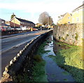
Plasmawr Road stream, Fairwater, Cardiff
The stream alongside Plasmawr Road is a tributary of the Ely River.
Behind the camera, the stream flows under Fairwater Road. http://www.geograph.org.uk/photo/3785426
Image: © Jaggery
Taken: 17 Dec 2013
0.10 miles
10
Fairwater Health Centre, Cardiff
Viewed across Plasmawr Road.
Image: © Jaggery
Taken: 17 Dec 2013
0.10 miles


