
IMAGES TAKEN NEAR TO
Limeslade Close, CARDIFF, CF5 3BD
Introduction
This page details the photographs taken nearby to Limeslade Close, CF5 3BD by members of the Geograph project.
The Geograph project started in 2005 with the aim of publishing, organising and preserving representative images for every square kilometre of Great Britain, Ireland and the Isle of Man.

There are currently over 7.5m images from over14,400 individuals and you can help contribute to the project by visiting https://www.geograph.org.uk
Image Map
Images are licensed for reuse under creativecommons.org/licenses/by-sa/2.0
Notes
- Clicking on the map will re-center to the selected point.
- The higher the marker number, the further away the image location is from the centre of the postcode.
Image Listing (67 Images Found)
Images are licensed for reuse under creativecommons.org/licenses/by-sa/2.0
Image
Details
Distance
1
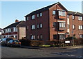
Flats on the corner of Norbury Road and Oxwich Close, Fairwater, Cardiff
Viewed across Norbury Road.
Image: © Jaggery
Taken: 17 Dec 2013
0.07 miles
2
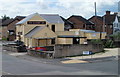
The Railway Inn, Cardiff
Pub on the corner of Ely Road and St Fagans Road, viewed from Western Avenue.
Image: © Jaggery
Taken: 22 Jul 2010
0.07 miles
3
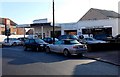
Fairwater Garage, Cardiff
On the corner of Finchley Road and Norbury Road.
Image: © Jaggery
Taken: 17 Dec 2013
0.08 miles
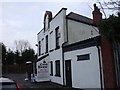
5
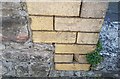
Ordnance Survey Cut Mark
This OS cut mark can be found on No36 St Fagan's Road. It marks a point 11.753m above mean sea level.
Image: © Adrian Dust
Taken: 18 Oct 2018
0.09 miles
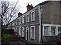
8
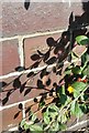
Ordnance Survey Cut Mark
This OS cut mark can be found on the north parapet of the railway bridge on Cowbridge Road West. It marks a point 15.868m above mean sea level.
Image: © Adrian Dust
Taken: 18 Oct 2018
0.10 miles
9
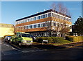
Fairwater Police Station, Cardiff
Part of the South Wales Police force, located in Norbury Road.
Image: © Jaggery
Taken: 17 Dec 2013
0.10 miles
10
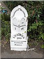
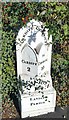
Old Milepost by the A48, Cowbridge Road West, Canton Parish
Glamorgan Gothic by the A48, in parish of Canton (City of Cardiff District), Cowbridge Road West; on Railway Bridge.
Inscription reads:-
: CARDIFF / 2 : : CARDIFF DISTRICT / LONDON 160 / LANDAFF / PARISH : : TO / COWBRIDGE / 10 :
Grade II listed by Cadw. Reference Number: 14085
https://cadwpublic-api.azurewebsites.net/reports/listedbuilding/FullReport?lang=&id=14085
Surveyed
Milestone Society National ID: GLA_160CFCB02.
Image: © Milestone Society
Taken: Unknown
0.11 miles