1
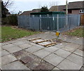
West along Radyr Court Road, Danescourt, Cardiff
From Danescourt Way.
Image: © Jaggery
Taken: 5 Mar 2015
0.02 miles
2
Restway Court, Danescourt Way, Cardiff
Managed by Wales & West Housing, Restway Court is retirement/sheltered housing containing 22 flats built in 1986.
Image: © Jaggery
Taken: 5 Mar 2015
0.03 miles
3
Into Danescourt Primary School, Cardiff
From Danescourt Way.
Image: © Jaggery
Taken: 5 Mar 2015
0.04 miles
4
East along Radyr Court Road, Danescourt, Cardiff
From Danescourt Way, towards the River Taff.
Image: © Jaggery
Taken: 5 Mar 2015
0.05 miles
5
The Radyr Court, Danescourt, Cardiff
Image: © John Lord
Taken: 4 Feb 2009
0.05 miles
6
Danescourt Shopping Centre electricity substation, Cardiff
The Western Power Distribution electricity substation is inside the brick compound on the right,
protected by locked grey gates with spiked tops.
The identifier is DANESCOURT SHOPPING CENTRE RADYR S/S 513089.
Image: © Jaggery
Taken: 5 Mar 2015
0.05 miles
7
King George V pillar box and grey phonebox, Danescourt, Cardiff
Alongside Cadoc Place, near Danescourt Way.
Image: © Jaggery
Taken: 5 Mar 2015
0.05 miles
8
Wales & West Utilities gas installation, Danescourt Way, Cardiff
A small yellow marker in front of the gas installation shows GAS PIPELINE.
Image: © Jaggery
Taken: 5 Mar 2015
0.06 miles
9
Radyr Court and the Co-operative Food Store, Danescourt, Cardiff
On the south side of Danescourt Way. Radyr Court pub is on the site of the medieval manor house Radyr Court, destroyed by fire in the 19th century. The building seen here on the right used to be a farmhouse.
Image: © Jaggery
Taken: 5 Mar 2015
0.06 miles
10
The Co-operative Food Store, Danescourt, Cardiff
Viewed from Cadoc Place on the south side of Danescourt Way.
Image: © Jaggery
Taken: 5 Mar 2015
0.06 miles


