
IMAGES TAKEN NEAR TO
Llantrisant Road, CARDIFF, CF5 2PW
Introduction
This page details the photographs taken nearby to Llantrisant Road, CF5 2PW by members of the Geograph project.
The Geograph project started in 2005 with the aim of publishing, organising and preserving representative images for every square kilometre of Great Britain, Ireland and the Isle of Man.

There are currently over 7.5m images from over14,400 individuals and you can help contribute to the project by visiting https://www.geograph.org.uk
Image Map
Images are licensed for reuse under creativecommons.org/licenses/by-sa/2.0
Notes
- Clicking on the map will re-center to the selected point.
- The higher the marker number, the further away the image location is from the centre of the postcode.
Image Listing (68 Images Found)
Images are licensed for reuse under creativecommons.org/licenses/by-sa/2.0
Image
Details
Distance
1
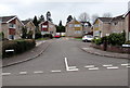
Roper Close, Danescourt, Cardiff
Short cul-de-sac viewed from Heol Seddon.
Image: © Jaggery
Taken: 5 Mar 2015
0.07 miles
2
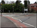
Zebra crossings, Llantristant Road, Danescourt, Cardiff
There are two separate zebra crossings, one across each carriageway of the A4119 Llantrisant Road,
a busy route to and from Cardiff city centre via Llandaff.
Image: © Jaggery
Taken: 5 Mar 2015
0.08 miles
3
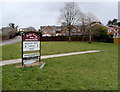
Notice for Radyr Court Shopping Precinct, Cardiff
At the edge of Llantrisant Road, pointing right towards this path. http://www.geograph.org.uk/photo/4374850
Image: © Jaggery
Taken: 5 Mar 2015
0.09 miles
4
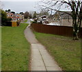
Path from Llantrisant Road to Heol Seddon, Danescourt, Cardiff
A notice near the path showing Radyr Court Shopping Precinct points this way.
Image: © Jaggery
Taken: 5 Mar 2015
0.09 miles
5
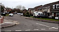
Piper Close, Danescourt, Cardiff
Cul-de-sac viewed from Heol Seddon.
Image: © Jaggery
Taken: 5 Mar 2015
0.09 miles
6
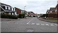
Heol Seddon, Danescourt, Cardiff
On the east side of Danescourt Way. Heol Seddon is a long cul-de-sac leading to several shorter ones.
Image: © Jaggery
Taken: 5 Mar 2015
0.09 miles
7
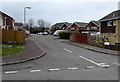
Epstein Close, Danescourt, Cardiff
90 metre long cul-de-sac on the NE side of Heol Seddon.
Image: © Jaggery
Taken: 5 Mar 2015
0.09 miles
8
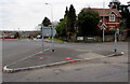
Triangular island at the northern end of Waterhall Road, Cardiff
At the Llantrisant Road junction. A sign shows ½ (mile) to Pentrebane, 1 to Fairwater.
Image: © Jaggery
Taken: 5 Mar 2015
0.10 miles
9
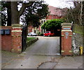
Entrance to Grade II listed Radyr Chain, Cardiff
From Waterhall Road near the Llantrisant Road junction.
The late Victorian (1894) villa was Grade II listed in 1993.
Image: © Jaggery
Taken: 5 Mar 2015
0.10 miles
10
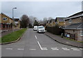
Woolmer Close, Danescourt, Cardiff
Viewed from Heol Seddon. Woolmer Close leads to Pace Close.
Image: © Jaggery
Taken: 5 Mar 2015
0.10 miles