1
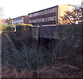
Fairwater Road housing, Cardiff
Flats and houses on the south side of Fairwater Road, viewed from the edge of a railway bridge,
looking towards the Fairwater Grove West junction.
Image: © Jaggery
Taken: 9 Jan 2014
0.07 miles
2
Ordnance Survey Cut Mark
This OS cut mark can be found on the wall of No32 Fairwater Road. It marks a point 32.205m above mean sea level.
Image: © Adrian Dust
Taken: 18 Oct 2018
0.09 miles
3
Steps from Fairwater Road to the railway, Cardiff
Viewed from here. http://www.geograph.org.uk/photo/3848763 There is a locked gate at the Fairwater Road end of the steps,
which may be disused, or perhaps used by railway staff.
Image: © Jaggery
Taken: 9 Jan 2014
0.10 miles
4
City Line towards Fairwater Road bridge, Cardiff
Viewed from Fairwater station footbridge. http://www.geograph.org.uk/photo/4040640
On the right, a long ramp ascends to Fairwater Road.
Image: © Jaggery
Taken: 9 Jan 2014
0.10 miles
5
Two bridges viewed from Fairwater railway station, Cardiff
Beyond the station footbridge, a bridge carries Fairwater Road over the City Line.
Image: © Jaggery
Taken: 9 Jan 2014
0.10 miles
6
Towards Fairwater Road railway bridge, Cardiff
Viewed from Fairwater railway station. On the right, a path connects the platform with Fairwater Road.
Image: © Jaggery
Taken: 9 Jan 2014
0.10 miles
7
Ordnance Survey Cut Mark
This OS cut mark can be found on the wall NW side of Fairwater Road. It marks a point 25.792m above mean sea level.
Image: © Adrian Dust
Taken: 18 Oct 2018
0.11 miles
8
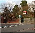
Southern entrance to Fairwater railway station, Cardiff
On the corner of Fairwater Road and Marionville Gardens.
Image: © Jaggery
Taken: 9 Jan 2014
0.11 miles
9
Cantonian High School
Image: © John Carter
Taken: 18 Nov 2008
0.11 miles
10
Cantonian High School, Cardiff
Penarth Head in the far distance
Image: © John Lord
Taken: 4 Feb 2009
0.11 miles


