
IMAGES TAKEN NEAR TO
Ely Road, CARDIFF, CF5 2DA
Introduction
This page details the photographs taken nearby to Ely Road, CF5 2DA by members of the Geograph project.
The Geograph project started in 2005 with the aim of publishing, organising and preserving representative images for every square kilometre of Great Britain, Ireland and the Isle of Man.

There are currently over 7.5m images from over14,400 individuals and you can help contribute to the project by visiting https://www.geograph.org.uk
Image Map
Images are licensed for reuse under creativecommons.org/licenses/by-sa/2.0
Notes
- Clicking on the map will re-center to the selected point.
- The higher the marker number, the further away the image location is from the centre of the postcode.
Image Listing (60 Images Found)
Images are licensed for reuse under creativecommons.org/licenses/by-sa/2.0
Image
Details
Distance
1
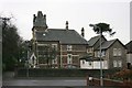
Fairfield House, Ely Road, Cardiff
This Victorian house is currently used as a care home and is managed by the charity Perthyn. The house was previously used as a nursing home.
Taken from Lloyd Avenue.
Image: © Adrian Platt
Taken: 13 Dec 2008
0.03 miles
2
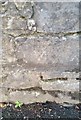
Ordnance Survey Cut Mark
This OS cut mark can be found on the wall of Gleneagles Court, Ely Road. It marks a point 15.947m above mean sea level.
Image: © Adrian Dust
Taken: 18 Oct 2018
0.04 miles
3
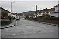
Windway Road, Llandaff, Cardiff
Windway Road taken from Ely Road on a damp December morning.
The wooded hill in the background is Leckwith Wood in ST1575.
Image: © Adrian Platt
Taken: 13 Dec 2008
0.04 miles
4
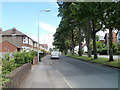
Tree-lined central reservation, Waun-gron Road, Cardiff
This tree-lined section of Waun-gron Road (B4488) is between Western Avenue and Ely Road. This view is from the corner of Western Avenue.
Image: © Jaggery
Taken: 22 Jul 2010
0.05 miles
5
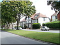
Large houses, Waun-gron Road, Cardiff
Located on the south side of the street, near the corner of Ely Road.
Image: © Jaggery
Taken: 22 Jul 2010
0.05 miles
6
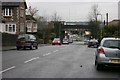
Railway bridge in Ely Road, Cardiff
This railway bridge Image is on the Radyr to Cardiff line, built by the Taff Vale Railway.
The A48 Western Avenue is just beyond the bridge, whilst in the distance can be seen the TV masts at Wenvoe in ST1174.
Image: © Adrian Platt
Taken: 13 Dec 2008
0.07 miles
7
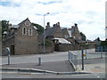
Corner of Ely Road and Waun-gron Road, Cardiff
The large building now has two occupiers. Nearest the camera is a private residence whose name, The Stables, describes its former usage. The major part of the building is a Conservative Club. http://www.geograph.org.uk/photo/1136914
Image: © Jaggery
Taken: 22 Jul 2010
0.07 miles
8
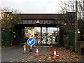
Railway Bridge
Repair work being carried out at the railway bridge over Ely Road.
Image: © Alan Hughes
Taken: 18 Nov 2016
0.08 miles
9
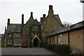
Fairwater Conservative Club, Cardiff
The Club is an imposing Victorian merchants house now used as a Club, and with a large modern extension. It has many memories for me as my wedding reception was held here in the long and hot summer of 1976 ! See also Image and Image
Image: © Adrian Platt
Taken: 24 Jan 2009
0.08 miles
10
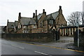
Fairwater Conservative Club, Cardiff
The street entrance and the main front of the building. On the extreme left can be seen the former stables now converted to mews cottages, somewhat noisy I guess as they back onto a busy crossroads. see also Image, and Image, and for the Waun Gron/Ely Road crossroads, see Image
Image: © Adrian Platt
Taken: 13 Dec 2008
0.08 miles