
IMAGES TAKEN NEAR TO
Llandaff Place, CARDIFF, CF5 2AE
Introduction
This page details the photographs taken nearby to Llandaff Place, CF5 2AE by members of the Geograph project.
The Geograph project started in 2005 with the aim of publishing, organising and preserving representative images for every square kilometre of Great Britain, Ireland and the Isle of Man.

There are currently over 7.5m images from over14,400 individuals and you can help contribute to the project by visiting https://www.geograph.org.uk
Image Map
Images are licensed for reuse under creativecommons.org/licenses/by-sa/2.0
Notes
- Clicking on the map will re-center to the selected point.
- The higher the marker number, the further away the image location is from the centre of the postcode.
Image Listing (36 Images Found)
Images are licensed for reuse under creativecommons.org/licenses/by-sa/2.0
Image
Details
Distance
1
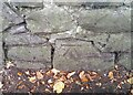
Ordnance Survey Cut Mark
This OS cut mark can be found on the wall SW side of Pencisely Road. It marks a point 23.656m above mean sea level.
Image: © Adrian Dust
Taken: 23 Sep 2021
0.07 miles
2
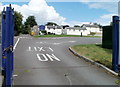
Southern entrance to Howell's School, Llandaff
Viewed from Pencisely Road.
Founded in 1860, Howell's School has a longstanding reputation as the foremost girls' school in Wales. Since 2005, boys have been admitted, but only those aged 16 to 18 (to the Sixth Form College).
Image: © Jaggery
Taken: 22 Jul 2010
0.08 miles
3
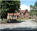
Penhill Close, Cardiff
Viewed from Pencisely Road.
Image: © Jaggery
Taken: 22 Jul 2010
0.08 miles
4
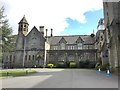
Howells School
Howells School, Llandaff.
Image: © Alan Hughes
Taken: 7 Apr 2016
0.08 miles
5
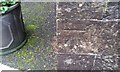
Ordnance Survey Cut Mark
This OS cut mark can be found on the NW face of the Howells School. It marks a point 26.115m above mean sea level.
Image: © Adrian Dust
Taken: 11 Nov 2017
0.09 miles
6
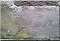
Ordnance survey Cut Mark
This OS cut mark can be found on the gatepost at the entrance to the Howells School. It marks a point 23.344m above mean sea level.
Image: © Adrian Dust
Taken: 11 Nov 2017
0.10 miles
7
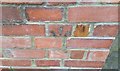
Ordnance Survey Cut Mark
This damaged OS cut mark can be found on the wall of Nos75 & 77 Pencisely Road. It marks a point 20.879m above mean sea level.
Image: © Adrian Dust
Taken: 15 Oct 2017
0.12 miles
8
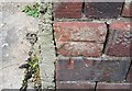
Ordnance Survey Cut Mark
This OS cut mark can be found on the wall post of No6 Pencisely Road. It marks a point 23.723m above mean sea level.
Image: © Adrian Dust
Taken: 15 Oct 2017
0.13 miles
9
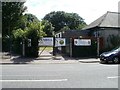
Penhill Bowls Club
A large sign on the gate informs the reader that Penhill Bowls Club is home of Cardiff Bus Bowls Club (established 1978) and Clwb Rybgi Cymry Caerdydd.
Image: © Jaggery
Taken: 22 Jul 2010
0.15 miles
10

Ordnance Survey Cut Mark
This OS cut mark can be found on the wall NE side of Cardiff Road. It marks a point 20.705m above mean sea level.
Image: © Adrian Dust
Taken: 15 Oct 2017
0.15 miles