
IMAGES TAKEN NEAR TO
Clive Road, CARDIFF, CF5 1HF
Introduction
This page details the photographs taken nearby to Clive Road, CF5 1HF by members of the Geograph project.
The Geograph project started in 2005 with the aim of publishing, organising and preserving representative images for every square kilometre of Great Britain, Ireland and the Isle of Man.

There are currently over 7.5m images from over14,400 individuals and you can help contribute to the project by visiting https://www.geograph.org.uk
Image Map
Images are licensed for reuse under creativecommons.org/licenses/by-sa/2.0
Notes
- Clicking on the map will re-center to the selected point.
- The higher the marker number, the further away the image location is from the centre of the postcode.
Image Listing (63 Images Found)
Images are licensed for reuse under creativecommons.org/licenses/by-sa/2.0
Image
Details
Distance
1
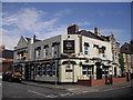
The Duke of Clarence, Cardiff
On the corner of Clive Rd and Pembroke Rd.
Image: © John Lord
Taken: 1 Aug 2010
0.05 miles
2

Ordnance Survey Cut Mark
This OS cut mark can be found on the east face of the Wesleyan Hall. It marks a point 10.250m above mean sea level.
Image: © Adrian Dust
Taken: 15 Oct 2017
0.06 miles
3
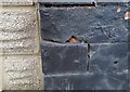
Ordnance Survey Cut Mark
This damaged OS cut mark can be found on No50 Clive Road. It marks a point 10.071m above mean sea level.
Image: © Adrian Dust
Taken: 15 Oct 2017
0.07 miles
4
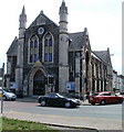
Salvation Army Citadel, Canton, Cardiff
Located on the corner of Cowbridge Road East and Grosvenor Street.
The Salvation Army's Canton Community Shop is on the opposite side of the road. http://www.geograph.org.uk/photo/1980769
Image: © Jaggery
Taken: 22 Jul 2010
0.09 miles
5
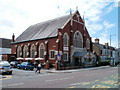
Wesley Methodist Church, Canton, Cardiff
Church dating from 1887 located on the corner of Cowbridge Road East and Nottingham Street.
Image: © Jaggery
Taken: 22 Jul 2010
0.09 miles
6
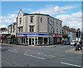
Canton Community Shop, Cardiff
Salvation Army premises on the corner of Cowbridge Road East and Clive Road.
Their Canton Citadel http://www.geograph.org.uk/photo/1980774 is opposite, on the other side of Cowbridge Road East.
Image: © Jaggery
Taken: 22 Jul 2010
0.09 miles
7
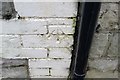
Ordnance Survey Cut Mark
This OS cut mark can be found on No288 Cowbridge Road East. It marks a point 10.106m above mean sea level.
Image: © Adrian Dust
Taken: 15 Oct 2017
0.09 miles
8
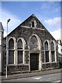
Former Sunday School hall, Ethel St, Cardiff
Sunday School is carved above the doorway.
Image: © John Lord
Taken: 1 Aug 2010
0.11 miles
9
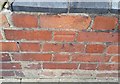
Ordnance Survey Cut Mark
This OS cut mark can be found on No23 Grosvenor Street. It marks a point 9.415m above mean sea level.
Image: © Adrian Dust
Taken: 15 Oct 2017
0.12 miles
10
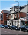
The Clive, Canton, Cardiff
Pub at 360 Cowbridge Road East, facing Lincoln Street. Built in the 19th century as the Clive Arms Hotel.
Image: © Jaggery
Taken: 22 Jul 2010
0.13 miles