1
Ordnance Survey Cut Mark
This OS cut mark can be found on No288 Cowbridge Road East. It marks a point 10.106m above mean sea level.
Image: © Adrian Dust
Taken: 15 Oct 2017
0.04 miles
2
The Maltings, Canton, Cardiff
Pub on the corner of Cowbridge Road East and Radnor Road. The pub was built in the early 1970s on the site of a former malt house.
Image: © Jaggery
Taken: 22 Jul 2010
0.04 miles
3
Bendy-bus on Cowbridge Road East, Canton
Image: © Ruth Sharville
Taken: 12 May 2009
0.08 miles
4
Ordnance Survey Cut Mark
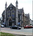
This OS cut mark can be found on the east face of the Wesleyan Hall. It marks a point 10.250m above mean sea level.
Image: © Adrian Dust
Taken: 15 Oct 2017
0.09 miles
5
Salvation Army Citadel, Canton, Cardiff
Located on the corner of Cowbridge Road East and Grosvenor Street.
The Salvation Army's Canton Community Shop is on the opposite side of the road. http://www.geograph.org.uk/photo/1980769
Image: © Jaggery
Taken: 22 Jul 2010
0.10 miles
6
Ordnance Survey Cut Mark
This OS cut mark can be found on No2A Northumberland Street. It marks a point 9.726m above mean sea level.
Image: © Adrian Dust
Taken: 23 Sep 2021
0.10 miles
7
Ancient sign plate in Canton
Image: © john bristow
Taken: 17 Feb 2018
0.10 miles
8
Cardiff District - Milestone
Historic (1835) milestone on Cowbridge Road East - with archaic spelling of Landaff Parish. Distances - Cardiff 2, Cowbridge 11, London 159 miles.
Image: © Colin Smith
Taken: 29 Feb 2020
0.10 miles
9
Old Milepost by Cowbridge Road East, Canton, Cardiff
Glamorgan Gothic by the former A4161, in parish of Canton (City of Cardiff District), Cowbridge Road East; outside No.240 on corner with Pen-y-peel Road, in pavement, back to stone garden wall.
Inscription reads:-
: TO / CARDIFF / 1 : : CARDIFF DISTRICT : : TO / COWBRIDGE / 11 : : LONDON / 159 : : LANDAFF / PARISH : : 1835 :
Grade II listed by Cadw.
Reference Number: 14078 https://cadwpublic-api.azurewebsites.net/reports/listedbuilding/FullReport?lang=&id=14078
Surveyed
Milestone Society National ID: GLA_159CFCB01
Image: © Milestone Society
Taken: Unknown
0.11 miles
10
Ordnance Survey Cut Mark
This OS cut mark can be found on No23 Grosvenor Street. It marks a point 9.415m above mean sea level.
Image: © Adrian Dust
Taken: 15 Oct 2017
0.11 miles


