
IMAGES TAKEN NEAR TO
Pentrebach, MERTHYR TYDFIL, CF48 4BB
Introduction
This page details the photographs taken nearby to CF48 4BB by members of the Geograph project.
The Geograph project started in 2005 with the aim of publishing, organising and preserving representative images for every square kilometre of Great Britain, Ireland and the Isle of Man.

There are currently over 7.5m images from over14,400 individuals and you can help contribute to the project by visiting https://www.geograph.org.uk
Image Map
Images are licensed for reuse under creativecommons.org/licenses/by-sa/2.0
Notes
- Clicking on the map will re-center to the selected point.
- The higher the marker number, the further away the image location is from the centre of the postcode.
Image Listing (124 Images Found)
Images are licensed for reuse under creativecommons.org/licenses/by-sa/2.0
Image
Details
Distance
1
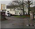
Grade II listed Pentrebach House, Pentrebach
Coflein records that Pentrebach House was an ironmaster's mansion said to have been built in 1850 for Anthony Hill of the Plymouth Ironworks in Merthyr Tydfil. The house is a substantial late Georgian to Italianate style country house. In the early 20th century the house was occupied by N.F. Hankey, the owner of Plymouth Collieries. Later used as an old people's home by the local authority, Pentrebach House was converted to an inn in the late 20th century. Grade II listed as a substantial house in the late Georgian style, of interest also as a surviving example of the house of a mid 19th century ironmaster.
In March 2019 names in view are Table Table pub & restaurant and Premier Inn.
Image: © Jaggery
Taken: 4 Mar 2019
0.01 miles
2
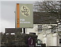
Table Table name sign, Pentrebach
Located here https://www.geograph.org.uk/photo/6079919 the Pentrebach House Table Table pub & restaurant name sign is alongside Duffryn Road.
Table Table is a brand of restaurants set up by Whitbread in 2008.
Most Table Tables are converted Brewers Fayres.
A Premier Inn name sign is also in view.
Image: © Jaggery
Taken: 4 Mar 2019
0.03 miles
3
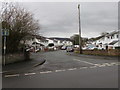
Greenfield Gardens towards Greenfield Court, Pentrebach
From Duffryn Road, the road named Greenfield Gardens leads to Greenfield Court.
Image: © Jaggery
Taken: 4 Mar 2019
0.03 miles
4

Ordnance Survey Cut Mark
This OS cut mark can be found on the wall at the junction with path SW side of the road. It marks a point 147.987m above mean sea level.
Image: © Adrian Dust
Taken: 20 Jul 2020
0.05 miles

6
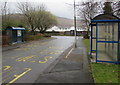
Pentrebach House bus stops and shelters, Pentrebach
The stop on the left is for buses to Bedlinog via Treharris or Bryngoleu via Aberfan.
The stop on the right is for buses to Merthyr Tydfil bus station.
Image: © Jaggery
Taken: 4 Mar 2019
0.05 miles
7
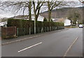
Hedge-lined part of Duffryn Road, Pentrebach
This part of Duffryn Road is on the approach to the Greenfield Gardens junction.
Image: © Jaggery
Taken: 4 Mar 2019
0.06 miles
8
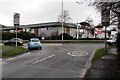
From 20 to 40 at the western end of Duffryn Road, Pentrebach
The 20mph speed limit in force near the village school increases to 40mph on the A4060.
Image: © Jaggery
Taken: 4 Mar 2019
0.07 miles
9

Junction of Duffryn Road and the A4060 in Pentrebach
From the left, Duffryn Road joins the A4060, here dual carriageway.
The roundabout in the background is at the A4054 junction.
Image: © Jaggery
Taken: 4 Mar 2019
0.08 miles
10

Greenhill Manor Care Home in Pentrebach
Set back from the west side of Duffryn Road.
Image: © Jaggery
Taken: 4 Mar 2019
0.08 miles