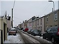
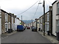
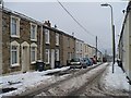
IMAGES TAKEN NEAR TO
Victoria Street, MERTHYR TYDFIL, CF48 3RW
Introduction
This page details the photographs taken nearby to Victoria Street, CF48 3RW by members of the Geograph project.
The Geograph project started in 2005 with the aim of publishing, organising and preserving representative images for every square kilometre of Great Britain, Ireland and the Isle of Man.

There are currently over 7.5m images from over14,400 individuals and you can help contribute to the project by visiting https://www.geograph.org.uk
Image Map
Images are licensed for reuse under creativecommons.org/licenses/by-sa/2.0
Notes
- Clicking on the map will re-center to the selected point.
- The higher the marker number, the further away the image location is from the centre of the postcode.
Image Listing (21 Images Found)
Images are licensed for reuse under creativecommons.org/licenses/by-sa/2.0
Image
Details
Distance
1
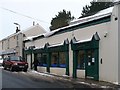
Dowlais Pharmacy
Situated in Victoria Street.
Image: © Robin Drayton
Taken: 11 Jan 2010
0.01 miles
2
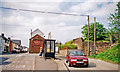
The Bruce, Dowlais (Year 2000)
Photographer Ben Brooksbank's Profile: http://www.geograph.org.uk/profile/44502
The Bruce Hotel on Victoria street in Dowlais, at its intersection with Odessa Street (left) and Station Street. Note the remains of a railway bridge over Station Street. Ivor Iron Works was just a few hundred metres to the North East of this location, until it closed in 1987 (demolished 1988). Dowlais Central Railway Station was just a short distance South of this location. See also Ivor Road, SSE of this location:
http://www.geograph.org.uk/photo/2220754
Image: © Ben Brooksbank (Geograph member)
Taken: Unknown
0.04 miles
4
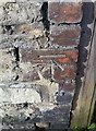
Ordnance Survey Cut Mark
This OS cut mark can be found on the wall west side of Victoria Street. It marks a point 314.078m above mean sea level.
Image: © Adrian Dust
Taken: 29 Oct 2017
0.09 miles
5
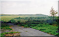
Site of the former Ivor Iron Works, Dowlais (Year 2000)
Photographer Ben Brooksbank's Profile: http://www.geograph.org.uk/profile/44502
The works closed in 1987 (demolished 1988). This photo was taken someplace on the site close to the Bruce Hotel on Victoria Street. See http://www.geograph.org.uk/photo/2220537.
The skyline is Merthyr Common, and you can also see a narrow shelter belt lying alongside the A4060 dual carriageway (Merthyr Eastern bypass). Much of the view takes in reclaimed land, as it would have formerly been dominated by an enormous slagheap that was nicknamed "Whitey" by the locals. Certainly when I first saw it, circa 1968, it looked a bit like a snow-covered mountain.
The following excellent historical site is a must if you have any interest in the Welsh 'Mountains of the Moon':
http://www.alangeorge.co.uk/old_merthyr.htm
http://www.alangeorge.co.uk/dowlais.htm
http://www.alangeorge.co.uk/iforworks.htm
Image: © Ben Brooksbank (Geograph member)
Taken: Unknown
0.09 miles
6
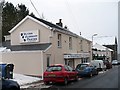
Veterinary Practice, Dowlais
Situated in Victoria Street.
Image: © Robin Drayton
Taken: 11 Jan 2010
0.09 miles
7
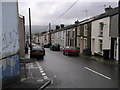
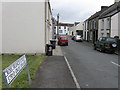
Francis Street, Dowlais
A typical street of 19th Century housing built for workers at the iron foundry which lay further up the hill, behind the camera position, and overlooked the town.
Image: © Geoff Harris
Taken: 21 May 2006
0.10 miles