
IMAGES TAKEN NEAR TO
Pontsticill, MERTHYR TYDFIL, CF48 2UW
Introduction
This page details the photographs taken nearby to CF48 2UW by members of the Geograph project.
The Geograph project started in 2005 with the aim of publishing, organising and preserving representative images for every square kilometre of Great Britain, Ireland and the Isle of Man.

There are currently over 7.5m images from over14,400 individuals and you can help contribute to the project by visiting https://www.geograph.org.uk
Image Map
Images are licensed for reuse under creativecommons.org/licenses/by-sa/2.0
Notes
- Clicking on the map will re-center to the selected point.
- The higher the marker number, the further away the image location is from the centre of the postcode.
Image Listing (74 Images Found)
Images are licensed for reuse under creativecommons.org/licenses/by-sa/2.0
Image
Details
Distance
1

Houses near the eastern boundary of Pontsticill
Viewed from near a village boundary sign. http://www.geograph.org.uk/photo/3168291
Image: © Jaggery
Taken: 25 Sep 2011
0.01 miles
2
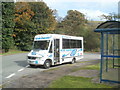
Globe Coaches bus at Taf Fechan Houses bus terminus, Pontsticill
A Globe Coaches bus awaits departure from Pontiscill terminus on the number 24 route to Merthyr Tydfil. Scheduled journey time to Merthyr bus station is 18 minutes. The final stop is at Rhydycar Leisure Centre 3 minutes later. There is an hourly frequency today, a Sunday.
Image: © Jaggery
Taken: 25 Sep 2011
0.02 miles
3

Eastern boundary of Pontsticill
Pontsticill is a village in the county borough of Merthyr Tydfil. It lies in the Taf Fechan valley on the southern edge of the Brecon Beacons National Park. Nearby are the southern edge of Pontsticill Reservoir, and Pontsticill station on the Brecon Mountain Railway.
Image: © Jaggery
Taken: 25 Sep 2011
0.06 miles
4

Northern boundary of Pontsticill
Pontsticill is a village in the county borough of Merthyr Tydfil. It lies in the Taf Fechan valley on the southern edge of the Brecon Beacons National Park.
Image: © Jaggery
Taken: 25 Sep 2011
0.08 miles
5

Heol Ponsticill / Ponsticill Road
Heol yn mynd mas o bentre Ponsticill.
Road heading out from Pontsticill village (trans. bridge of the stile).
Image: © Alan Richards
Taken: 20 Aug 2017
0.13 miles
6

The dam at Pontsticill Reservoir
Looking from the West. Opposite view to Image
Image: © Stuart Wilding
Taken: 16 Mar 2009
0.13 miles
7

Turn left for the reservoir and railway, Pontsticill
A sign opposite a farm building http://www.geograph.org.uk/photo/2618480 points towards the Brecon Mountain Railway. The route to the railway skirts the edge of Pontsticill Reservoir. Dowlais is 3 miles away and Merthyr Tydfil 4 miles away.
Image: © Jaggery
Taken: 25 Sep 2011
0.14 miles
8
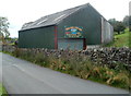
Corrugated metal farm building, Ponsticill
From a distance, I thought this building was the Red Cow Inn, but the sign shows that the pub http://www.geograph.org.uk/photo/2618039 is 150 yards ahead. Located at a fork in the road at the northern edge of Pontsticill.
Image: © Jaggery
Taken: 25 Sep 2011
0.14 miles

10

Forest clearance west of Pontsticill Reservoir
Image: © David Smith
Taken: 21 Sep 2022
0.14 miles