1
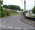
Meirion Place, Heolgerrig, Merthyr Tydfil
Meirion Place is the row of three houses in the foreground. Behind them is Danyronen, also a row of three houses.
Image: © Jaggery
Taken: 13 Jun 2012
0.02 miles
2
Heolgerrig preceded by A470
Taken from a recently developed retail park, this pic shows over The A470 Trunk road Heolgerrig and beyond to Mynydd Aberdar And one of its transmitters
Image
Image: © Bonelli
Taken: Unknown
0.04 miles
3
Coronation Terrace, Heolgerrig, Merthyr Tydfil
Coronation Terrace is a row of 12 houses on the south side of the main road through the Heolgerrig district of Merthyr Tydfil.
Image: © Jaggery
Taken: 13 Jun 2012
0.04 miles
4
Style, Cut 'n Comb, Heolgerrig, Merthyr Tydfil
Hairdressers' premises located in the former Marbury Stores building
on the corner of Castle View and Heolgerrig.
Image: © Jaggery
Taken: 13 Jun 2012
0.04 miles
5
Six Bells Estate houses, Heolgerrig, Merthyr Tydfil
Out of shot on the left, the street name sign shows SIX BELLS ESTATE LEADING TO MARTIN CLOSE.
Image: © Jaggery
Taken: 13 Jun 2012
0.06 miles
6
Brondeg, Heolgerrig Merthyr Tydfil
The residential road Brondeg climbs away from the corner of Farm Terrace.
Image: © Jaggery
Taken: 13 Jun 2012
0.10 miles
7
Heolgerrig bungalows, Merthyr Tydfil
Heolgerrig is the name both of this road and the district of Merthyr Tydfil through which it runs.
Image: © Jaggery
Taken: 13 Jun 2012
0.10 miles
8
Houses at the NW end of Brondeg, Heolgerrig, Merthyr Tydfil
Viewed from the corner of Heolgerrig, the main road through the Merthyr Tydfil district also named Heolgerrig.
Image: © Jaggery
Taken: 13 Jun 2012
0.11 miles
9
Heol Gerrig Stores, Heolgerrig, Merthyr Tydfil
A Premier store on the corner of Farm Road and Heolgerrig.
Image: © Jaggery
Taken: 13 Jun 2012
0.11 miles
10
Heolgerrig Social Club and Alpha House, Heolgerrig, Merthyr Tydfil
Located on the corner of Heolgerrig and Cwmglo Road.
Alpha House is located on the right of, and behind, Heolgerrig Social Club. It is the meeting place of Nation Changers Church. Their banner is on the fence in the foreground.
Image: © Jaggery
Taken: 13 Jun 2012
0.11 miles


