1
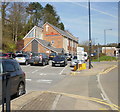
Merthyr Tydfil Council Offices
Image: © Ian S
Taken: 26 May 2014
0.02 miles
2
Salvation Army Citadel, Merthyr Tydfil
In 1878 two young evangelists arrived in Merthyr Tydfil for the purpose of establishing a branch of a new religious organisation known as the Christian Mission. The organisation was later renamed the Salvation Army. In the early years, various premises were used. The Salvation Army's current citadel in Glebeland Place, shown here, opened in 1937 and has since been extensively modernised.
Image: © Jaggery
Taken: 21 Apr 2010
0.02 miles
3
River Taff, Merthyr Tydfil
Looking across the River Taff with Merthyr Tydfil Council offices on the left and the bus station to the right.
Image: © Robin Drayton
Taken: 4 Mar 2014
0.04 miles
4
Glebeland Place, Merthyr Tydfil
Viewed across the Avenue de Clichy.
Salvation Army Citadel http://www.geograph.org.uk/photo/1826252 on the left, council offices on the right.
Image: © Jaggery
Taken: 16 Jun 2014
0.05 miles
5
River Taff at Merthyr Tydfil
In the image, one can see the bridge carrying Penry Street over the River. The picture has been taken from the cycle path (shared use): this is NCN 8 (Taff Trail) which runs from Cardiff to Brecon.
Image: © shirokazan
Taken: 18 Jul 2010
0.05 miles
6
A4054 bridge over Taff, Merthyr Tydfil
Image: © David Smith
Taken: 17 Sep 2022
0.05 miles
7
Merthyr Tydfil Civic Centre
Viewed across Avenue de Clichy (A4054).
Image: © Jaggery
Taken: 13 Jun 2012
0.05 miles
8
Road junction opposite Merthyr Tydfil Civic Centre
Viewed from the edge of a bridge http://www.geograph.org.uk/photo/3000234 across the River Taff. Turn left for Cefn Coed y Cymmer and Dowlais, or right for Rhydycar and Cardiff.
Image: © Jaggery
Taken: 13 Jun 2012
0.05 miles
9
Shingle islet in the Taff, Merthyr Tydfil
Viewed from the edge of the Avenue de Clichy.
Image: © Jaggery
Taken: 16 Jun 2014
0.06 miles
10
War Memorial in Merthyr Tydfil town centre
The Celtic Cross is on the corner of Castle Street and Glebeland Place.
Image: © Jaggery
Taken: 27 Feb 2019
0.06 miles


