1
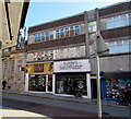
Two High Street barbershops, Merthyr Tydfil
Mint Barbers at 68 High Street and Darko's Barbershop at 67B High Street.
Image: © Jaggery
Taken: 27 Feb 2019
0.02 miles
2
St David's Church, Merthyr Tydfil
Image: © John Lord
Taken: 1 Feb 2012
0.03 miles
3
St David's Church, Merthyr Tydfil
Image: © John Lord
Taken: 1 Feb 2012
0.03 miles
4
High Street, Merthyr Tydfil
North end of the pedestrianised section of High Street. Facing North.
Image: © Kev Griffin
Taken: 15 Nov 2004
0.03 miles
5
Ordnance Survey Cut Mark
This OS cut mark can be found on the wall of the Miner's Hall, Church Street. It marks a point 180.4386m above mean sea level.
Image: © Adrian Dust
Taken: 27 Apr 2014
0.04 miles
6
High Street, Merthyr Tydfil
'Ladybirds' in the grand building in the centre is a hairdressing emporium.
Image: © Jonathan Billinger
Taken: 14 Mar 2008
0.04 miles
7
Ordnance Survey 1GL Bolt
This damaged OS Bolt can be found on the west face of St David's Church. It marks a point 176.495m above mean sea level.
Image: © Adrian Dust
Taken: 13 Jun 2015
0.04 miles
8
St David?s Church, Merthyr Tydfil
St David's was built in 1846-7 to house the growing English-speaking congregation. St Tydfil's was the parish church at that time and was mainly Welsh-speaking. St David's is a large church built in the Victorian Gothic Early English style although the interior is mostly 20th century.
Image: © Richard Rogerson
Taken: 31 Jan 2011
0.04 miles
9
Church Street, Thomastown
The facade of the Miners' Hall stands on Church Street, formerly Shiloh Welsh Wesleyan Chapel. http://www.merthyr-history.com/?p=936 It was destroyed by fire in 1992.
Image: © Eirian Evans
Taken: 22 Jul 2019
0.04 miles
10
Miners' Hall, Merthyr Tydfil
As I was taking the photo, a passer-by expressed in strong terms her disgust at a) the unsightliness of the ruin and b) the misspelling of the street name in front of it, Heol-yr-Reglwys instead of Heol-yr-Eglwys (Church St, for non-Welsh speakers).
Image: © John Lord
Taken: 1 Feb 2012
0.04 miles


