1
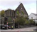
Former Unitarian Church, Merthyr Tydfil
Image: © John Lord
Taken: 1 Feb 2012
0.02 miles
2
Ordnance Survey Cut Mark
This heavily painted OS cut mark can be found on the front of the Brunswick Hotel, Church Street. It marks a point 184.7271m above mean sea level.
Image: © Adrian Dust
Taken: 27 Apr 2014
0.03 miles
3
Ordnance Survey Cut Mark
This OS cut mark can be found on the Brunswich Hotel. It marks a point 184.727m above mean sea level.
Image: © Adrian Dust
Taken: 29 Oct 2017
0.03 miles
4
Ordnance Survey Cut Mark
This OS cut mark can be found on No21 Lower Thomas Street. It marks a point 180.807m above mean sea level.
Image: © Adrian Dust
Taken: 29 Oct 2017
0.04 miles
5
Church Street, Thomastown
The facade of the Miners' Hall stands on Church Street, formerly Shiloh Welsh Wesleyan Chapel. http://www.merthyr-history.com/?p=936 It was destroyed by fire in 1992.
Image: © Eirian Evans
Taken: 22 Jul 2019
0.04 miles
6
Miners' Hall, Merthyr Tydfil
As I was taking the photo, a passer-by expressed in strong terms her disgust at a) the unsightliness of the ruin and b) the misspelling of the street name in front of it, Heol-yr-Reglwys instead of Heol-yr-Eglwys (Church St, for non-Welsh speakers).
Image: © John Lord
Taken: 1 Feb 2012
0.04 miles
7
Ordnance Survey Cut Mark
This OS cut mark can be found on the wall of the Miner's Hall, Church Street. It marks a point 180.4386m above mean sea level.
Image: © Adrian Dust
Taken: 27 Apr 2014
0.04 miles
8
Miners Hall, Merthyr Tudful
Originally known as Shiloh Chapel, it changed use to become a miners' welfare hall.
Image: © Chris Andrews
Taken: 20 Nov 2014
0.05 miles
9
The Miners Arms
A town centre pub situated in the basement of a ruined church, on Church Street, Merthyr Tydfil.
Image: © Jonathan Billinger
Taken: 14 Mar 2008
0.05 miles
10
Ordnance Survey Cut Mark
This OS cut mark can be found on the wall post of Bryn Heulog, Bryntirion Road. It marks a point 192.673m above mean sea level.
Image: © Adrian Dust
Taken: 29 Oct 2017
0.06 miles


