
IMAGES TAKEN NEAR TO
Shingrig Road, TREHARRIS, CF46 6EA
Introduction
This page details the photographs taken nearby to Shingrig Road, CF46 6EA by members of the Geograph project.
The Geograph project started in 2005 with the aim of publishing, organising and preserving representative images for every square kilometre of Great Britain, Ireland and the Isle of Man.

There are currently over 7.5m images from over14,400 individuals and you can help contribute to the project by visiting https://www.geograph.org.uk
Image Map
Images are licensed for reuse under creativecommons.org/licenses/by-sa/2.0
Notes
- Clicking on the map will re-center to the selected point.
- The higher the marker number, the further away the image location is from the centre of the postcode.
Image Listing (139 Images Found)
Images are licensed for reuse under creativecommons.org/licenses/by-sa/2.0
Image
Details
Distance
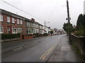
2
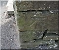
Ordnance Survey Cut Mark
This OS cut mark can be found on the gatepost of No56 Shingrig Road. It marks a point 151.909m above mean sea level.
Image: © Adrian Dust
Taken: 25 May 2019
0.02 miles
3
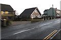
Housing variety in Nelson
Viewed across the B4255 Shingrig Road.
Image: © Jaggery
Taken: 17 Dec 2018
0.02 miles
4
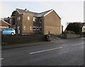
Fairfield, Nelson
Fairfield residential care home viewed across the B4255 Shingrig Road in Nelson.
Image: © Jaggery
Taken: 17 Dec 2018
0.02 miles
5
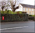
King George V postbox in a stone wall, Shingrig Road, Nelson
The GR on the box is short for Georgius Rex, Latin for King George,
in this case King George V who reigned from May 1910-January 1936.
Image: © Jaggery
Taken: 17 Dec 2018
0.03 miles
6
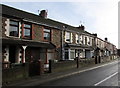
Shingrig Road houses, Nelson
Houses on the east side of the B4255 Shingrig Road.
Image: © Jaggery
Taken: 17 Dec 2018
0.03 miles
7
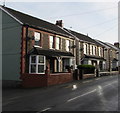
Five houses and five satellite dishes, Shingrig Road, Nelson
Four semi-detached houses and a detached house viewed across the B4255 Shingrig Road.
Image: © Jaggery
Taken: 17 Dec 2018
0.04 miles
8
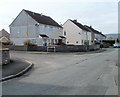
Corner of Tawelfan and Rowan Close, Nelson
Viewed across Tawelfan.
Image: © Jaggery
Taken: 17 Mar 2011
0.04 miles
9
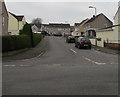
Ffos Close, Nelson
Cul-de-sac on the southwest side of the road named Tawelfan.
Image: © Jaggery
Taken: 5 Jan 2019
0.06 miles
10
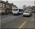
X38 bus, Shingrig Road, Nelson
N.A.T. Group bus travelling southeastwards on the B4255 Shingrig Road towards
Nelson bus station on bus route X38 from Bargoed to Pontypridd bus station.
Image: © Jaggery
Taken: 5 Jan 2019
0.07 miles