1
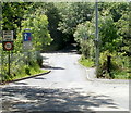
Path through Taff Bargoed Millennium Park, Trelewis
Viewed from near this http://www.geograph.org.uk/photo/3220842 entrance.
The park is on the site of the former Taff Merthyr and Deep Navigation Collieries.
Image: © Jaggery
Taken: 24 May 2011
0.05 miles
2
Ordnance Survey Cut Mark
This OS cut mark can be found on The Old Surgery. It marks a point 123.252m above mean sea level.
Image: © Adrian Dust
Taken: 1 Feb 2021
0.05 miles
3
Ordnance Survey Cut Mark
This OS cut mark can be found on the north side of the road. It marks a point 129.756m above mean sea level.
Image: © Adrian Dust
Taken: 1 Feb 2021
0.06 miles
4
Shared path in Taff Bargoed Community Park
Image: © David Smith
Taken: 27 Sep 2021
0.07 miles
5
Autocare Service, Trelewis
Tyres, servicing, repairs and MoT test centre, located near a hairpin bend in Cardiff Road (B4255).
Image: © Jaggery
Taken: 24 May 2011
0.07 miles
6
Beechcroft, Trelewis
Modern houses on the north side of Glyn Bargoed Road.
Image: © Jaggery
Taken: 24 May 2011
0.07 miles
7
An entrance to Taff Bargoed Millennium Park, Trelewis
The park is on the site of the former Taff Merthyr and Deep Navigation Collieries.
Image: © Jaggery
Taken: 24 May 2011
0.08 miles
8
Sculpture near the entrance to Taff Bargoed Millennium Park, Trelewis
Viewed along the footpath to a park entrance.
Image: © Jaggery
Taken: 24 May 2011
0.08 miles
9
Ffaldcaiach and High Street houses, Trelewis
A view north along the B4255 which is named Ffaldcaiach in the foreground
and becomes High Street ahead, north of the Glyn Bargoed Road junction. http://www.geograph.org.uk/photo/3220825
At the left edge of the view is Trelewis War Memorial. http://www.geograph.org.uk/photo/3220797
Image: © Jaggery
Taken: 24 May 2011
0.09 miles
10
Eastern end of Mill Street, Trelewis
Viewed from the B4254 Glyn Bargoed Road which becomes the B4254 Cardiff Road here.
A sign shows a (relatively) weak bridge ahead (33 tonnes weight limit) on Mill Street.
Image: © Jaggery
Taken: 24 May 2011
0.09 miles


