IMAGES TAKEN NEAR TO
TREHARRIS, CF46 5PG

Introduction

This page details the photographs taken nearby to CF46 5PG by members of the Geograph project.

The Geograph project started in 2005 with the aim of publishing, organising and preserving representative images for every square kilometre of Great Britain, Ireland and the Isle of Man.

There are currently over 7.5m images from over14,400 individuals and you can help contribute to the project by visiting https://www.geograph.org.uk

Image Map


Images are licensed for reuse under creativecommons.org/licenses/by-sa/2.0
Notes
  • Clicking on the map will re-center to the selected point.
  • The higher the marker number, the further away the image location is from the centre of the postcode.

Image Listing (51 Images Found)

Images are licensed for reuse under creativecommons.org/licenses/by-sa/2.0
  • ...
Image
Details
Distance
1
Penydarren tramway at Quakers Yard Viaduct
This Tramway (now a Cycleway) was the site of the first ever journey by steam train in February 1804 when Trevithick ran from the Penydarren Ironworks to Abercynon and back. Above it passes the later 1841 Taff Valley Railway.
Image: © nantcoly Taken: 29 Nov 2005
0.08 miles
2
Cattle grid on minor road near Edwardsville
Image: © Gareth James Taken: 6 Aug 2016
0.08 miles
3
Lay-by by A470, west of Abercynon
Image: © David Smith Taken: 21 Sep 2022
0.12 miles
4
Taff Trail passing under Quaker's Yard viaduct
About to pass under the Goitre Coed Viaduct. There is access to Quaker's Yard train station about 100 metres past the viaduct on a grassy path to the right of the trail - best suited to walkers or mountain bikes.
Image: © John Light Taken: 4 Jan 2013
0.13 miles
5
Goitre-Coed Road bridge over A470, Abercynon
Image: © David Smith Taken: 21 Sep 2022
0.13 miles
6
One arch of the railway bridge over Taff Trail, near Quaker's Yard
Image: © David Smith Taken: 17 Sep 2022
0.13 miles
7
Goitre-Coed Road bridge over A470
The minor road gives access to Mynydd Goitre-Coed, the hamlet of Goitre-Coed and the quarries in the area.
Image: © David Smith Taken: 7 Jul 2011
0.14 miles
8
Railway line to Merthyr
Looking down onto the Abercynon-Merthyr Tydfil line, which is in a deep cutting at this point.
Image: © Gareth James Taken: 6 Aug 2016
0.14 miles
9
Towards Abercynon from Quakers Yard railway station
Viewed from the eastern edge of the single platform at Quakers Yard railway station on the Merthyr Tydfil branch of the Merthyr Line. Abercynon station is about 2km ahead.
Image: © Jaggery Taken: 27 Mar 2014
0.14 miles
10
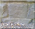
Ordnance Survey Cut Mark
This OS cut mark can be found on the SE parapet of the railway bridge. It marks a point 143.436m above mean sea level.
Image: © Adrian Dust Taken: 22 Jul 2018
0.15 miles
  • ...