
IMAGES TAKEN NEAR TO
Parc Abercynon, MOUNTAIN ASH, CF45 4UY
Introduction
This page details the photographs taken nearby to Parc Abercynon, CF45 4UY by members of the Geograph project.
The Geograph project started in 2005 with the aim of publishing, organising and preserving representative images for every square kilometre of Great Britain, Ireland and the Isle of Man.

There are currently over 7.5m images from over14,400 individuals and you can help contribute to the project by visiting https://www.geograph.org.uk
Image Map
Images are licensed for reuse under creativecommons.org/licenses/by-sa/2.0
Notes
- Clicking on the map will re-center to the selected point.
- The higher the marker number, the further away the image location is from the centre of the postcode.
Image Listing (34 Images Found)
Images are licensed for reuse under creativecommons.org/licenses/by-sa/2.0
Image
Details
Distance
1
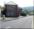
Park View, Abercynon
Park View descends from Greenfield Terrace into the valley of the Afon Cynon.
Image: © Jaggery
Taken: 10 Aug 2012
0.07 miles
2
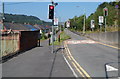
Narrow section of Greenfield Terrace roadway, Abercynon
Traffic lights maintain an alternating flow of traffic along a section of road ahead where there is an 8' 6" width limit and a 7.5 tonnes weight limit.
The road here occupies a narrow shelf between the A4059, several metres higher up, on the top of the bank on the right, and land sloping down into the valley of the Afon Cynon on the left.
Image: © Jaggery
Taken: 10 Aug 2012
0.10 miles
3
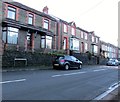
Houses above Abercynon Road, Abercynon
Houses on this side of the B4275 Abercynon Road are set slightly above road level.
Houses on the camera side at set slightly below road level.
Image: © Jaggery
Taken: 4 Feb 2019
0.12 miles
4
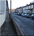
Pavement below Abercynon Road, Abercynon
Houses on this side of the B4275 Abercynon Road are set slightly below road level.
Houses on the opposite side are set slightly above road level.
Image: © Jaggery
Taken: 4 Feb 2019
0.12 miles
5
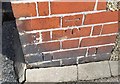
Ordnance Survey Cut Mark
This OS cut mark can be found on the house, Glencoe, at the road junction. It marks a point 104.120m above mean sea level.
Image: © Adrian Dust
Taken: 7 Oct 2018
0.12 miles
6
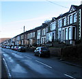
Abercynon Road houses, Abercynon
Viewed across the B4275 Abercynon Road from Pontcynon. The Abercynon boundary sign is behind the camera.
Image: © Jaggery
Taken: 4 Feb 2019
0.13 miles
7
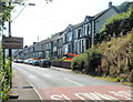
NW boundary of Abercynon
The B4275 from Pontcynon reaches Abercynon, a village in the Cynon valley
in Rhondda Cynon Taf county borough.
Image: © Jaggery
Taken: 10 Aug 2012
0.13 miles
8
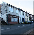
Excentric in Abercynon
Excentric Hair Design is at 1A Abercynon Road.
Image: © Jaggery
Taken: 4 Feb 2019
0.13 miles
9
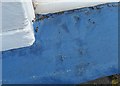
Ordnance Survey Rivet
This damaged OS rivet can be found on the window sill of No36 Bassett Street. It marks a point 102.285m above mean sea level.
Image: © Adrian Dust
Taken: 27 May 2019
0.13 miles
10
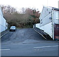
Side road ascending from the B4275 in Abercynon
Excentric Hair Design at 1A Abercynon Road is on the right. https://www.geograph.org.uk/photo/6047400
Image: © Jaggery
Taken: 4 Feb 2019
0.14 miles