1
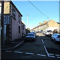
Ordnance Survey Cut Mark
This OS cut mark can be found on No36 Ynysmeurig Road. It marks a point 94.043m above mean sea level.
Image: © Adrian Dust
Taken: 7 Oct 2018
0.01 miles
2
Up North Street, Abercynon
From Ynysmeurig Road, North Street ascends towards West Street and Bassett Street.
The 20mph speed limit near the village school increases to 30mph.
Image: © Jaggery
Taken: 4 Feb 2019
0.01 miles
3
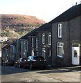
Houses alongside a steep descent, Ynysmeurig Road, Abercynon
The B4275 Ynysmeurig Road descends from Mountain Ash Road.
Image: © Jaggery
Taken: 4 Feb 2019
0.01 miles
4
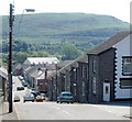
Steep descent, Ynysmeurig Road, Abercynon
Viewed from near the corner of Edward Street. Ynysmeurig Road descends towards the central shopping area of Abercynon.
Image: © Jaggery
Taken: 10 Aug 2012
0.02 miles
5
Ynysmeurig Road, Abercynon
Image: © Roger Cornfoot
Taken: 14 Mar 2009
0.02 miles
6
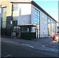
Ynysmeurig Road bus stop and shelter, Abercynon
Alongside the B4275 Ynysmeurig Road at the edge of Abercynon Library.
Image: © Jaggery
Taken: 4 Feb 2019
0.02 miles
7
Abercynon Library, Ynysmeurig Road, Abercynon
Viewed in February 2019. The public library and lifelong learning centre which opened in 2013 replaced this library https://www.geograph.org.uk/photo/3076231 nearby viewed in August 2012. LLYFRGELL is Welsh for LIBRARY.
Image: © Jaggery
Taken: 11 Feb 2019
0.03 miles
8
A view NE along Edward Street, Abercynon
Viewed from the corner of Herbert Street, looking towards Ynysmeurig Road.
Image: © Jaggery
Taken: 10 Aug 2012
0.03 miles
9
South side of Abercynon Community Primary School
Viewed from Ynysmeurig Road in February 2019. The purpose-built school which opened in September 2013 has replaced the outdated facilities at the former Abercynon Infants School, Carnetown Primary School and Abertaf Primary School. Abercynon Community Primary School occupies the site of the former Abercynon Infants School.
Image: © Jaggery
Taken: 11 Feb 2019
0.03 miles
10
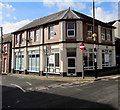
Former public library on an Abercynon corner
On the corner of Ynysmeurig Road and Walter Street. Name signs on windows in February 2019 show Little Playhouse Cafe & Soft Play. The library seen here https://www.geograph.org.uk/photo/3076231 in August 2012 has been replaced by this https://www.geograph.org.uk/photo/6056944 purpose-built library and lifelong learning centre nearby.
Image: © Jaggery
Taken: 11 Feb 2019
0.03 miles


