1
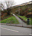
Path ascending from Pentwyn Avenue, Tyntetown
Towards houses in Bryntirion.
Image: © Jaggery
Taken: 6 Feb 2019
0.05 miles
2
Pentwyn Avenue, Tyntetown
Image: © Roger Cornfoot
Taken: 14 Mar 2009
0.06 miles
3
Tynte Hotel in Tyntetown
Pub & restaurant alongside the B4275 Main Road in Tyntetown, a small village near Penrhiwceiber. Tyntetown was formerly known as Matthewstown. The present-day name is a reference to Halswell Milbourne Kemeys-Tynte who owned the estate on which the village was built.
Image: © Jaggery
Taken: 6 Feb 2019
0.06 miles
4
Tynte Hotel, Tyntetown
Pub & restaurant alongside the B4275 Main Road in Tyntetown, a small village near Penrhiwceiber. Tyntetown was formerly known as Matthewstown. The present-day name is a reference to Halswell Milbourne Kemeys-Tynte, a former owner of the estate on which the village is built.
Image: © Jaggery
Taken: 6 Feb 2019
0.07 miles
5
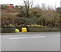
Yellow grit bins, Main Road, Tyntetown
On the south side of the B4275 Main Road opposite steep Milbourne Street. https://www.geograph.org.uk/photo/6052744
Image: © Jaggery
Taken: 6 Feb 2019
0.07 miles
6
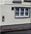
Grey postbox in a Main Road wall, Tyntetown
In the wall of Mary's Fish & Chip shop https://www.geograph.org.uk/photo/6052728 viewed on February 6th 2019. It looks like an undercoat has been applied during a repaint of the box. The presence of a postbox here suggests that the building is likely to have been the village post office.
Image: © Jaggery
Taken: 6 Feb 2019
0.07 miles
7
Mary's Fish & Chip shop in Tyntetown
Main Road shop on the corner of Milbourne Street.
Image: © Jaggery
Taken: 6 Feb 2019
0.07 miles
8
Two dark green cabinets alongside Pentwyn Avenue, Tyntetown
Telecoms cabinets on the south side of the B4275 Pentwyn Avenue.
Image: © Jaggery
Taken: 6 Feb 2019
0.09 miles
9
Zebra crossing, Main Road, Tyntetown
Across the B4275 Main Road. The zigzag white lines indicate the no parking area near the zebra crossing.
Image: © Jaggery
Taken: 6 Feb 2019
0.09 miles
10
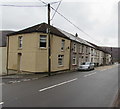
Row of houses, Main Road, Tyntetown
Extending for 45 metres along the north side of the B4275 Main Road from Milbourne Street to Halswell Street. The two street names are a reference to Halswell Milbourne Kemeys-Tynte who owned the estate on which the village was built.
Image: © Jaggery
Taken: 6 Feb 2019
0.10 miles


