1
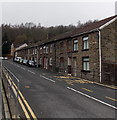
Vaughan Terrace Penrhiwceiber
This part of the B4275 is between Rheola Street behind the camera and Abercynon Road out of shot ahead.
Image: © Jaggery
Taken: 30 Jan 2014
0.02 miles
2
Ordnance Survey Cut Mark
This OS cut mark can be found on the wall west side of Abercynon Road. It marks a point 116.806m above mean sea level.
Image: © Adrian Dust
Taken: 15 Apr 2018
0.02 miles
3
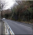
From Vaughan Terrace to Abercynon Road, Penrhiwceiber
The B4275 Vaughan Terrace http://www.geograph.org.uk/photo/3891234 behind the camera becomes the B4275 Abercynon Road ahead.
Image: © Jaggery
Taken: 30 Jan 2014
0.03 miles
4
Penrikyber Colliery site plaque in Penrhiwceiber
The plaque is on the wall of this http://www.geograph.org.uk/photo/3891278 sports pavilion. The spelling Penrikyber,
the Anglicised form of Penrhiwceiber, is rarely seen today except in historical contexts.
Image: © Jaggery
Taken: 30 Jan 2014
0.04 miles
5
Sports pavilion on the site of a former colliery in Penrhiwceiber
A plaque http://www.geograph.org.uk/photo/3891286 on the building at the edge of Rheola Street commemorates the employees who worked and died in Penrikyber Colliery, a 3-shaft mine complex which occupied this site from 1879-1985.
The spelling Penrikyber, the Anglicised name of the village, is rarely seen today except in historical contexts.
Image: © Jaggery
Taken: 30 Jan 2014
0.05 miles
6
Change of name along the B4275 in Penrhiwceiber
The B4275 Rheola Street becomes the B4275 Vaughan Terrace ahead.
Rheola Street continues as an unclassified road on the left.
Image: © Jaggery
Taken: 30 Jan 2014
0.05 miles
7
Uneven road surface in Penrhiwceiber
Viewed from the corner of Glasbrook Terrace and Rheola Street along an
unnamed road connecting the southern ends of Glanlay Street and Morris Avenue.
Image: © Jaggery
Taken: 30 Jan 2014
0.06 miles
8
South along Glanlay Street, Penrhiwceiber
Viewed from Cynon Terrace looking past Happy Valley takeaway.
Image: © Jaggery
Taken: 4 Feb 2014
0.06 miles
9
Keepings Coaches and an Ulsterbus in Penrhiwceiber
The vehicles are parked at the southern end of Rheola Street in the SE of the village. Two Keepings Coaches are on the left. The bus on the right retains the livery, name (Ulsterbus Translink) and fleet number (1406) of a former usage. There is at least one other former Ulsterbus vehicle in this area.
Here's http://www.geograph.org.uk/photo/3854600 1343 in Aberdare.
Image: © Jaggery
Taken: 30 Jan 2014
0.06 miles
10
Southern end of Rheola Street, Penrhiwceiber
Looking north towards the B4275 from the edge of a recreation area on the site of the former Penrhikyber Colliery. http://www.geograph.org.uk/photo/3891286
Image: © Jaggery
Taken: 30 Jan 2014
0.07 miles


