1
Darran Las Community Building, Mountain Ash
45 metre (nearly 150 ft) long building viewed across the B4275 Aberdare Road.
Image: © Jaggery
Taken: 19 Feb 2014
0.04 miles
2
Aberdare Road houses, Mountain Ash
Viewed from the corner of Harcourt Road.
Image: © Jaggery
Taken: 19 Feb 2014
0.06 miles
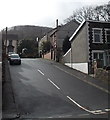
3
Harcourt Road, Mountain Ash
Viewed across Aberdare Road.
Image: © Jaggery
Taken: 19 Feb 2014
0.07 miles
4
Ordnance Survey Cut Mark
This OS cut mark can be found on the wall SE side of the road. It marks a point 128.479m above mean sea level.
Image: © Adrian Dust
Taken: 19 Jan 2018
0.08 miles
5
Ordnance Survey Cut Mark
This OS cut mark can be found on the wall SW side of Aberdare Road. It marks a point 117.040m above mean sea level.
Image: © Adrian Dust
Taken: 19 Jan 2018
0.09 miles
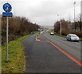
6
Cynon Trail marker, Mountain Ash
This part of the Cynon Trail footpath and cycle route is alongside the A4059 New Road.
Image: © Jaggery
Taken: 25 Jan 2014
0.10 miles
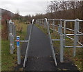
7
Inward-sloping barrier at the entrance to cycle route 478 in Mountain Ash
The cycle route entrance is from New Road near this Welcome sign. http://www.geograph.org.uk/photo/3948196
Image: © Jaggery
Taken: 25 Jan 2014
0.11 miles
8
Cynon Valley Miners Memorial in Mountain Ash
Located at the edge of Parc Dyffryn Pennar, the home ground of Mountain Ash Rugby Football Club,
on the site of the former Deep Duffryn Colliery. A plaque shows
THIS MEMORIAL IS ERECTED UPON THE PIT HEAD OF THE FORMER DEEP DUFFRYN COLLIERY IN MEMORY OF ALL THOSE CYNON VALLEY MINERS WHOSE LABOUR AND SOCIAL CONSCIENCE SHAPED OUR COMMUNITIES AND SOCIETY.
A sign showing DANGER MINE GASES and another one showing No Smoking are reminders that this remains a dangerous location.
Image: © Jaggery
Taken: 25 Jan 2014
0.12 miles
9
Stream flows towards Afon Cynon, Mountain Ash
Its bed stained by decades of industrial discharges, a stream flows away from New Road towards its confluence with a river, Afon Cynon, 50 metres from the camera.
Image: © Jaggery
Taken: 25 Jan 2014
0.12 miles
10
Welcome to Mountain Ash
The speed limit along the A4059 New Road from Cwmbach reduces from 40mph to 30mph here.
Image: © Jaggery
Taken: 25 Jan 2014
0.12 miles


