IMAGES TAKEN NEAR TO
A4059, ABERDARE, CF44 9QL
Introduction
This page details the photographs taken nearby to A4059, CF44 9QL by members of the Geograph project.
The Geograph project started in 2005 with the aim of publishing, organising and preserving representative images for every square kilometre of Great Britain, Ireland and the Isle of Man.

There are currently over 7.5m images from over14,400 individuals and you can help contribute to the project by visiting https://www.geograph.org.uk
Image Map
Images are licensed for reuse under creativecommons.org/licenses/by-sa/2.0
Notes
- Clicking on the map will re-center to the selected point.
- The higher the marker number, the further away the image location is from the centre of the postcode.
Image Listing (18 Images Found)
Images are licensed for reuse under creativecommons.org/licenses/by-sa/2.0
Image
Details
Distance
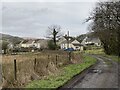
1
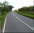
The A4059 climbs away from Penderyn
Viewed from near the northern boundary http://www.geograph.org.uk/photo/3059602 of Penderyn. Ahead, on the way to the Storey Arms Centre, the road reaches a height of about 450 metres (c 1,475 ft) above sea level. Most of the route is through moorland where trees are few and stunted, but sheep and spectacular views are plentiful.
Image: © Jaggery
Taken: 29 Jul 2012
0.02 miles
2
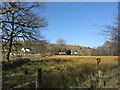
Farmland near Tor y Foel
Moel Penderyn in the background.
Image: © Alan Hughes
Taken: 26 Feb 2020
0.02 miles
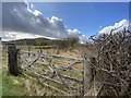
3
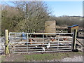
Ynys Wendraeth
Cattle grid at Ynys Wendraeth farm.
Image: © Alan Hughes
Taken: 26 Feb 2020
0.04 miles
4
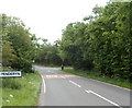
Northern boundary of Penderyn
The A4059 reaches the northern edge of Penderyn, a village in Rhondda Cynon Taf.
Image: © Jaggery
Taken: 29 Jul 2012
0.09 miles
8
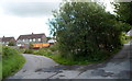
Triangular junction, Penderyn
The triangle is at the junction of Chapel Road (on the left) and the road south to St Cynog's Church and the Red Lion. Inside the triangle, on this side shielded by trees, are hen coops.
Image: © Jaggery
Taken: 29 Jul 2012
0.18 miles
9
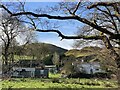
Returning to Penderyn
A good starting point for a walk into waterfall country.
Image: © Alan Hughes
Taken: 19 Feb 2024
0.19 miles
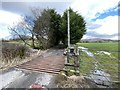
10
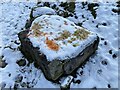
Dining table
Vegetable scrapings have been carefully placed on a large stone to provide food for wild animals. A fox’s print can be seen in the foreground.
Image: © Alan Hughes
Taken: 25 Jan 2021
0.19 miles