IMAGES TAKEN NEAR TO
Llwynderi, ABERDARE, CF44 9DN

Introduction

This page details the photographs taken nearby to Llwynderi, CF44 9DN by members of the Geograph project.

The Geograph project started in 2005 with the aim of publishing, organising and preserving representative images for every square kilometre of Great Britain, Ireland and the Isle of Man.

There are currently over 7.5m images from over14,400 individuals and you can help contribute to the project by visiting https://www.geograph.org.uk

Image Map


Images are licensed for reuse under creativecommons.org/licenses/by-sa/2.0
Notes
  • Clicking on the map will re-center to the selected point.
  • The higher the marker number, the further away the image location is from the centre of the postcode.

Image Listing (59 Images Found)

Images are licensed for reuse under creativecommons.org/licenses/by-sa/2.0
  • ...
Image
Details
Distance
1
Misty Penywaun landscape.
Misty Penywaun landscape, looking out from the What Shop area towards Llwydcoed.
Image: © Darren W Rees Taken: 6 Feb 2008
0.06 miles
2
Scaffolding on Coedglas houses in Penywaun
Some of many houses undergoing external work in Penywaun at the end of January 2015.
Image: © Jaggery Taken: 31 Jan 2015
0.06 miles
3
Coedglas, Penywaun
Viewed from the corner of Awelfryn.
Image: © Jaggery Taken: 31 Jan 2015
0.07 miles
4
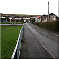
Grass rectangle in Penywaun
The 15 metres wide rectangle extends for 45 metres from Haulfryn on this side to Llwynderi ahead. The houses on the left are in Bryncoed. http://www.geograph.org.uk/photo/4330089
Image: © Jaggery Taken: 31 Jan 2015
0.08 miles
5
Western end of Bronllys, Penywaun
Viewed from the corner of Gwladys Street looking along Bronllys towards Haulfryn, Awelfryn and Llwynderi.
Image: © Jaggery Taken: 31 Jan 2015
0.09 miles
6
Haulfryn, Penywaun
One of many streets in Penywaun with a Welsh name, Haulfryn heads ESE from Arfryn.
Image: © Jaggery Taken: 31 Jan 2015
0.09 miles
7
Awelfryn, Penywaun
Looking SSW along Awelfryn towards Haulfryn. Gwladys Street Play Area http://www.geograph.org.uk/photo/4334099 is on the left.
Image: © Jaggery Taken: 31 Jan 2015
0.09 miles
8
Bryncoed houses in Penywaun
On the west side of a grass rectangle. http://www.geograph.org.uk/photo/4330084
Image: © Jaggery Taken: 31 Jan 2015
0.09 miles
9
Grass triangle in Penywaun
At the junction of Haulfryn, Bronllys and Gwladys Street.
Image: © Jaggery Taken: 31 Jan 2015
0.10 miles
10
Gwladys Street Play Area in Penywaun
Between Gwladys Street (on this side) and Awelfryn.
Image: © Jaggery Taken: 31 Jan 2015
0.10 miles
  • ...