1
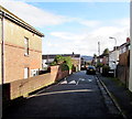
Speed bumps across Llyswen, Penywaun
I was surprised to see two sets of speed bumps here, one each side of the car. This narrow side road
is only 70 metres long, between Gwladys Street on this side and a 90 degree bend in the road ahead.
Image: © Jaggery
Taken: 31 Jan 2015
0.06 miles
2
Colliers Arms, Penywaun
Looks to be closed, I'm afraid.
Image: © Jonathan Billinger
Taken: 22 Aug 2013
0.07 miles
3
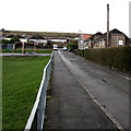
NNE through Heol Keir Hardie, Penywaun
Heol Keir Hardie is aligned west to east in a looplike course extending for 450 metres, north of Hirwaun Road and east of Gwladys Street. The road ahead is from the southern edge of the loop to its northern edge.
Image: © Jaggery
Taken: 31 Jan 2015
0.08 miles
4
Penywaun Primary School
Set back from Dan-yr-Heol near the Coedglas junction.
Image: © Jaggery
Taken: 31 Jan 2015
0.08 miles
5
Traffic calming on Gwladys Street, Penywaun
A white triangle has been painted on each of the speed bumps on a main street through Penywaun.
Image: © Jaggery
Taken: 31 Jan 2015
0.11 miles
6
Grass triangle in Penywaun
At the junction of Haulfryn, Bronllys and Gwladys Street.
Image: © Jaggery
Taken: 31 Jan 2015
0.11 miles
7
Gwladys Street Play Area in Penywaun
Between Gwladys Street (on this side) and Awelfryn.
Image: © Jaggery
Taken: 31 Jan 2015
0.12 miles
8
Cana Centre, Penywaun
Viewed across Gwladys Street. The Cana Centre is a base for the Penywaun Enterprise Partnership which exists to further the social, economic and environmental wellbeing of the Penywaun Ward. Projects include an after-school club and a crèche.
Image: © Jaggery
Taken: 31 Jan 2015
0.12 miles
9
Gwladys Street, Penywaun
As a point of reference, the sign on the house for sale gives a price of £74,500. The average house price in the UK in mid-2013 is over £242,000.
Image: © Jonathan Billinger
Taken: 22 Aug 2013
0.12 miles
10
Awelfryn, Penywaun
Looking SSW along Awelfryn towards Haulfryn. Gwladys Street Play Area http://www.geograph.org.uk/photo/4334099 is on the left.
Image: © Jaggery
Taken: 31 Jan 2015
0.12 miles


