
IMAGES TAKEN NEAR TO
Mount Pleasant Street, ABERDARE, CF44 8NF
Introduction
This page details the photographs taken nearby to Mount Pleasant Street, CF44 8NF by members of the Geograph project.
The Geograph project started in 2005 with the aim of publishing, organising and preserving representative images for every square kilometre of Great Britain, Ireland and the Isle of Man.

There are currently over 7.5m images from over14,400 individuals and you can help contribute to the project by visiting https://www.geograph.org.uk
Image Map
Images are licensed for reuse under creativecommons.org/licenses/by-sa/2.0
Notes
- Clicking on the map will re-center to the selected point.
- The higher the marker number, the further away the image location is from the centre of the postcode.
Image Listing (76 Images Found)
Images are licensed for reuse under creativecommons.org/licenses/by-sa/2.0
Image
Details
Distance
1
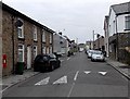
Mount Pleasant Street towards Ebenezer Street, Trecynon
There is a King George VI postbox http://www.geograph.org.uk/photo/3967712 in the wall on the left. The left turn is into David Street.
Image: © Jaggery
Taken: 3 May 2014
0.01 miles
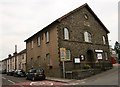
3
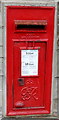
King George VI postbox, Mount Pleasant Street, Trecynon
In the wall here. http://www.geograph.org.uk/photo/3967703
Image: © Jaggery
Taken: 3 May 2014
0.03 miles
4
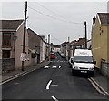
Margaret Street, Trecynon
Looking NW from the corner of Mount Pleasant Street and Alma Street.
Image: © Jaggery
Taken: 3 May 2014
0.03 miles
5
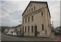
Trecynon Public Hall and Library
Trecynon Public Hall and Library on Mill Street, Trecynon.
Image: © Darren W Rees
Taken: 24 Jul 2008
0.04 miles
6
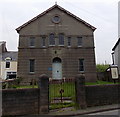
Unitarian Chapel, Trecynon
Viewed across Alma Street. An information board states that the Cynon Valley's first Nonconformist Chapel was established on this site in 1751 by members of the Cwm-y-glo Chapel on Merthyr Mountain. The first chapel they built here was described by the Swansea and Glamorgan Herald as, from a little distance, looking like a labourer's cottage or an inn of the humbler sort.
By 1861, the little chapel was in disrepair, and the growing size of the congregation needed more space, so the original chapel was demolished and replaced by the building seen here. The chapel has been closed for worship since 1995.
Image: © Jaggery
Taken: 3 May 2014
0.04 miles
7
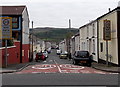
Frederick Street, Trecynon
Viewed across Hirwaun Road.
Image: © Jaggery
Taken: 3 May 2014
0.04 miles
8
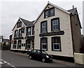
Brynhyfryd, Trecynon
Viewed across Mount Pleasant Street. This side shows the pub's Welsh name.
The far side http://www.geograph.org.uk/photo/3967534 shows its English name, Mount Pleasant (Hotel).
Image: © Jaggery
Taken: 3 May 2014
0.04 miles
9
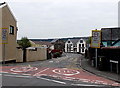
Mount Pleasant Street, Trecynon
Viewed across the B4275 Hirwaun Road looking towards the Mount Pleasant Hotel. http://www.geograph.org.uk/photo/3967534
A 20mph maximum speed zone is in force past the west side of Aberdare Park Primary School. http://www.geograph.org.uk/photo/3967675
Image: © Jaggery
Taken: 3 May 2014
0.05 miles
10

David Street, Trecynon
Viewed from the Hirwaun Road; New Hope Mission Church is the pebbledash building on the left corner.
Image: © Jonathan Billinger
Taken: 22 Aug 2013
0.06 miles