1
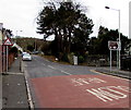
Right turn for the Dare Valley
Viewed across the A4233 Monk Street. A white arrow on a brown sign points
right along Highland Place towards the Dare Valley (Cwmdâr in Welsh).
Image: © Jaggery
Taken: 5 Feb 2015
0.01 miles
2
Trevor Street, Aberdare
Viewed across Monk Street.
Image: © Jaggery
Taken: 5 Feb 2015
0.01 miles
3
A4233 SW of Highland Place, Aberdare
Part of a long, steep ascent away from the centre of Aberdare.
Image: © Jaggery
Taken: 5 Feb 2015
0.02 miles
4
Trevor Street, Aberdare
Image: © Roger Cornfoot
Taken: 3 Apr 2017
0.02 miles
5
Gates at the entrance to a footpath and cycleway from Aberdare to Cwmaman
Walkers and cyclists use the small gate to access the way ahead. http://www.geograph.org.uk/photo/4340771
The wider gate is closed, secured by a metal chain and padlock.
Image: © Jaggery
Taken: 5 Feb 2015
0.03 miles
6
Graig Isaf Aberdare electricity substation
The Western Power Distribution electricity substation is on the west side of the A4233, near Bwllfa Graig water treatment works. http://www.geograph.org.uk/photo/4340799
Image: © Jaggery
Taken: 5 Feb 2015
0.03 miles
7
Footpath and cycleway on a former railway route from Aberdare to Cwmaman
The blue sign show 1¾ (miles) to Cwmaman. The sign pointing the other way show ¼ to the Dare Valley Country Park. The brown notice on the right shows DARE-AMAN RAILWAY PATH - NO CARS OR MOTORCYCLES.
Image: © Jaggery
Taken: 5 Feb 2015
0.03 miles
8
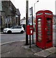
Old phonebox and new postbox in Aberdare
Alongside a bus stop on the corner of Ynysllwyd Street and Monk Street.
Image: © Jaggery
Taken: 5 Feb 2015
0.03 miles
9
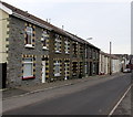
Row of houses, Highland Place, Aberdare
Viewed looking towards the A4233 Monk Street.
Image: © Jaggery
Taken: 5 Feb 2015
0.04 miles
10
Highland Place bus stop pole, Aberdare
I used "bus stop pole" instead of "bus stop" because it's unclear whether this is still a bus stop. Others I passed in Aberdare today all have yellow BUS STOP and the Welsh equivalent painted on the road surface. There is no timetable information here, only an indication that this is (was?) part of bus route 2, which means nothing to this visitor to Aberdare.
Image: © Jaggery
Taken: 5 Feb 2015
0.04 miles


