1
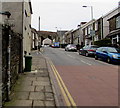
Monk Street SW of Mary Street, Aberdare
Heading away from the centre of Aberdare, the A4233 Monk Street ascends past the Mary Street junction.
Image: © Jaggery
Taken: 5 Feb 2015
0.03 miles
2
Old-style bus stop sign alongside Monk Street, Aberdare
Located near the John Street junction. There are no bus stop markings on the adjacent road.
Image: © Jaggery
Taken: 5 Feb 2015
0.03 miles
3
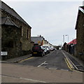
Monk Street, Aberdare
Image: © Roger Cornfoot
Taken: 27 Feb 2022
0.03 miles
4
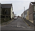
Monk Street
View along Monk Street, Aberdare.
Image: © Alan Hughes
Taken: 16 Mar 2020
0.04 miles
5
St Joseph's Catholic Church in Aberdare
Viewed across Monk Street. St Joseph's is part of the RC Parish of Mary Immaculate,
together with Our Lady of Lourdes in Mountain Ash and St Therese of Lisieux in Hirwaun.
Image: © Jaggery
Taken: 5 Feb 2015
0.04 miles
6
SE corner of St Joseph's Catholic Church, Aberdare
On the corner of Monk Street and Pendarren Street, St Joseph's is part of the RC Parish of Mary Immaculate, together with Our Lady of Lourdes in Mountain Ash and St Therese of Lisieux in Hirwaun.
Image: © Jaggery
Taken: 5 Feb 2015
0.04 miles
7
Pendarren Street, Aberdare
Viewed across Monk Street. The street name sign on the left, at the edge of St Joseph's Catholic Church, http://www.geograph.org.uk/photo/4337446 shows that Pendarren Street leads to Bryn Awel.
Image: © Jaggery
Taken: 5 Feb 2015
0.04 miles
8
Unity Street, Aberdare
Viewed across Monk Street. Highland Place Unitarian Church http://www.geograph.org.uk/photo/4337551 is on the left.
Image: © Jaggery
Taken: 5 Feb 2015
0.04 miles
9
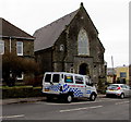
Silver Fox Karting van in Aberdare
Parked outside Highland Place Unitarian Church. http://www.geograph.org.uk/photo/4337551 Karting (or kart racing) is a motor sport with small, open, 4-wheeled vehicles called karts or go-karts, usually raced on scaled-down circuits.
Image: © Jaggery
Taken: 5 Feb 2015
0.05 miles
10
Ordnance Survey Cut Mark
This OS cut mark can be found on the wall of the Unitarian Church. It marks a point 156.835m above mean sea level.
Image: © Adrian Dust
Taken: 1 Jun 2017
0.05 miles


