1
Rooftop solar panels, Heol Pendyrus, Penrhys
On the NW side of this large grassy roundabout. http://www.geograph.org.uk/photo/4419219
Image: © Jaggery
Taken: 30 Mar 2015
0.04 miles
2
Penrhys houses
Viewed from Heol Pendyrus looking across Heol Dyfed towards Heol Mair.
Image: © Jaggery
Taken: 30 Mar 2015
0.05 miles
3
Large grassy roundabout in Penrhys
At the junction of Penrhys Road and Heol Pendyrus, the roundabout is about 50 metres by 35 metres.
Image: © Jaggery
Taken: 30 Mar 2015
0.06 miles
4
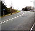
Heol Pendyrus, Penrhys
Heol Pendyrus is the outer circular road around residential Penrhys.
Here, Heol Pendyrus approaches the roundabout at the B4512 Penrhys Road junction.
The black arrow on a sign points left towards the Arts Centre.
Image: © Jaggery
Taken: 30 Mar 2015
0.07 miles
5
Low gear for 1 mile on the descent from Penrhys to Ystrad
The sign is alongside the B4512 Penrhys Road. Ahead, a sign shows a 12% gradient. http://www.geograph.org.uk/photo/4409487
Image: © Jaggery
Taken: 30 Mar 2015
0.08 miles
6
Nearly at the top of the climb up the B4512, Penrhys
The long steep ascent from Ystrad ends a few tens of metres beyond the directions sign.
Image: © Jaggery
Taken: 30 Mar 2015
0.09 miles
7
Gas installation near the entrance to Penrhys Cemetery
The Wales & West Utilities installation is inside a locked metal compound.
Image: © Jaggery
Taken: 30 Mar 2015
0.09 miles
8
Penrhys footpath
Between houses in Heol Mair and Heol Ioan.
Image: © Jaggery
Taken: 30 Mar 2015
0.09 miles
9
Heol Teifionydd lockup garages, Penhrys
Near the Heol Pendyrus junction.
Image: © Jaggery
Taken: 30 Mar 2015
0.09 miles
10
Western boundary of Penrhys
The boundary sign is alongside the B4512 Penrhys Road near the top of a long steep climb from Ystrad.
Below the boundary sign, a brown sign points right towards Rhondda Golf Club.
Image: © Jaggery
Taken: 30 Mar 2015
0.09 miles


