1
Ordnance Survey Cut Mark
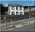
This OS cut mark can be found on the wall of No16 Pleasant View. It marks a point 176.010m above mean sea level.
Image: © Adrian Dust
Taken: 3 Mar 2021
0.01 miles
2
Pleasant View
Image: © Colin Pyle
Taken: 4 Jan 2010
0.02 miles
3
Tylorstown Clinic
Set below Ferndale Road, Tylorstown Clinic on the right is located near Sheppards Pharmacy. http://www.geograph.org.uk/photo/3610915
Image: © Jaggery
Taken: 20 Aug 2013
0.03 miles
4
Pedestrian refuge, Ferndale Road, Tylorstown
Pedestrians crossing the A4233 Ferndale Road can wait in the central area when traffic is heavy.
A pharmacy http://www.geograph.org.uk/photo/3610915 and a clinic http://www.geograph.org.uk/photo/3610938 are on the opposite side of the road.
Image: © Jaggery
Taken: 20 Aug 2013
0.04 miles
5
Former County Police Station, Tylorstown
Viewed across the A4233 Ferndale Road. The year of construction, 1900, is shown alongside the name. The building is now in residential use. I do not know when the police station closed down.
Image: © Jaggery
Taken: 20 Aug 2013
0.05 miles
6
Old Police Station, Ferndale Rd
Image: © John Lord
Taken: 6 Sep 2008
0.07 miles
7
Sheppards Pharmacy, Tylorstown
The pharmacy is set back from the east side of Ferndale Road.
Tylorstown Clinic http://www.geograph.org.uk/photo/3610938 is nearby.
Image: © Jaggery
Taken: 20 Aug 2013
0.07 miles
8
Ordnance Survey Cut Mark
This OS cut mark can be found on No19 Penrhys Road. It marks a point 206.472m above mean sea level.
Image: © Adrian Dust
Taken: 24 Jun 2017
0.08 miles
9
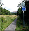
Cycle route north of Llanwonno Road bridge, Stanleytown
Viewed from the north side of this http://www.geograph.org.uk/photo/3598923 bridge. Distances shown along National Cycle Network
route 881 are 3 (miles) to Maerdy, 1¼ to Ferndale and ¼ to Tylorstown.
Image: © Jaggery
Taken: 8 Aug 2013
0.08 miles
10
Shadowy bus shelter in Tylorstown
Located alongside the A4233 Pleasant View.
At the roundabout ahead, straight on for Ferndale, Maerdy and Aberdare, or turn left for Penrhys and locations in the Rhondda Fawr valley (this is the Rhondda Fach valley).
Image: © Jaggery
Taken: 20 Aug 2013
0.08 miles


