
IMAGES TAKEN NEAR TO
Baglan Street, FERNDALE, CF43 3LS
Introduction
This page details the photographs taken nearby to Baglan Street, CF43 3LS by members of the Geograph project.
The Geograph project started in 2005 with the aim of publishing, organising and preserving representative images for every square kilometre of Great Britain, Ireland and the Isle of Man.

There are currently over 7.5m images from over14,400 individuals and you can help contribute to the project by visiting https://www.geograph.org.uk
Image Map
Images are licensed for reuse under creativecommons.org/licenses/by-sa/2.0
Notes
- Clicking on the map will re-center to the selected point.
- The higher the marker number, the further away the image location is from the centre of the postcode.
Image Listing (44 Images Found)
Images are licensed for reuse under creativecommons.org/licenses/by-sa/2.0
Image
Details
Distance
1
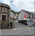
Tog's Fish Bar, Pontygwaith
On the corner of Brewery Street and Baglan Street.
Image: © Jaggery
Taken: 8 Aug 2013
0.02 miles
2
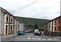
Baglan Street, Pontygwaith
Baglan Street descends towards Brewery Street from the corner of Madeline Street and Tanybryn Terrace.
Image: © Jaggery
Taken: 8 Aug 2013
0.04 miles
3
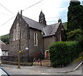
Former St Mary Magdalene Church Pontygwaith
Viewed across Madeline Street. The church, dating from the late 19th century, ceased to be used as a place of worship at the end of October 1997.
Image: © Jaggery
Taken: 8 Aug 2013
0.04 miles
4
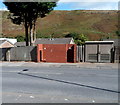
Brick urinal, Pontygwaith
The Brewery Street structure is a basic urinal (no pedestals or wash basins). Though such facilities have largely disappeared from many parts of South Wales, basic urinals (of varying designs) remain a common sight in the Rhondda. This one appears to have been recently built or rebuilt.
Image: © Jaggery
Taken: 19 Sep 2012
0.05 miles
5
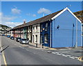
A blue and deep blue corner in Pontygwaith
This is the corner of Llewellyn Street (ahead) and Dolgwilym Street.
Image: © Jaggery
Taken: 19 Sep 2012
0.05 miles
6
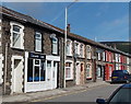
Kieranz Kutz Barbers, Pontygwaith
Viewed across Llewellyn Street.
Image: © Jaggery
Taken: 20 Aug 2013
0.06 miles
7
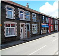
Pontygwaith Newsagents
R & LI Hughes, Newsagents, 76 Llewellyn Street, Pontygwaith.
Image: © Jaggery
Taken: 19 Sep 2012
0.06 miles
8
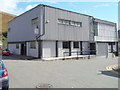
Pontygwaith Non-Political Club, Pontygwaith
On the corner of Dolgwilym Street and Grove House Court.
Image: © Jaggery
Taken: 19 Sep 2012
0.06 miles
9
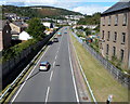
A4233 through Pontygwaith
Built in 2005, the A4233 is the Porth and Lower Rhondda Fach Relief Road (Porth Bypass), which follows the route of a dismantled railway line. Soar chapel http://www.geograph.org.uk/photo/3587498 is on the right.
Image: © Jaggery
Taken: 19 Sep 2012
0.08 miles
10
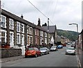
Madeline Street Pontygwaith
Viewed from near the corner of Baglan Street looking past the former St Mary Magdalene Church. http://www.geograph.org.uk/photo/3591047
Image: © Jaggery
Taken: 8 Aug 2013
0.08 miles