1
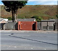
Brick urinal, Pontygwaith
The Brewery Street structure is a basic urinal (no pedestals or wash basins). Though such facilities have largely disappeared from many parts of South Wales, basic urinals (of varying designs) remain a common sight in the Rhondda. This one appears to have been recently built or rebuilt.
Image: © Jaggery
Taken: 19 Sep 2012
0.05 miles
2
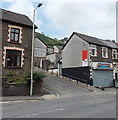
Tog's Fish Bar, Pontygwaith
On the corner of Brewery Street and Baglan Street.
Image: © Jaggery
Taken: 8 Aug 2013
0.05 miles
3
Colourful houses, The Avenue, Pontygwaith
The Stagecoach single-decker is on bus route 124 from Maerdy to Cardiff via Porth.
Image: © Jaggery
Taken: 19 Sep 2012
0.05 miles
4
Ordnance Survey Cut Mark
This OS cut mark can be found on No1 The Avenue. It marks a point 150.556m above mean sea level.
Image: © Adrian Dust
Taken: 18 Jun 2017
0.05 miles
5
Baglan Street, Pontygwaith
Baglan Street descends towards Brewery Street from the corner of Madeline Street and Tanybryn Terrace.
Image: © Jaggery
Taken: 8 Aug 2013
0.06 miles
6
Brewery Street, Pontygwaith
Some maps show Brewery Terrace, but estate agents' websites agree that this is Brewery Street.
The view is SSE towards Fenwick Street.
Image: © Jaggery
Taken: 19 Sep 2012
0.09 miles
7
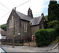
Former St Mary Magdalene Church Pontygwaith
Viewed across Madeline Street. The church, dating from the late 19th century, ceased to be used as a place of worship at the end of October 1997.
Image: © Jaggery
Taken: 8 Aug 2013
0.09 miles
8
A4233 through Pontygwaith
Built in 2005, the A4233 is the Porth and Lower Rhondda Fach Relief Road (Porth Bypass), which follows the route of a dismantled railway line. Soar chapel http://www.geograph.org.uk/photo/3587498 is on the right.
Image: © Jaggery
Taken: 19 Sep 2012
0.09 miles
9
Pontygwaith Non-Political Club, Pontygwaith
On the corner of Dolgwilym Street and Grove House Court.
Image: © Jaggery
Taken: 19 Sep 2012
0.10 miles
10
A blue and deep blue corner in Pontygwaith
This is the corner of Llewellyn Street (ahead) and Dolgwilym Street.
Image: © Jaggery
Taken: 19 Sep 2012
0.10 miles


