1
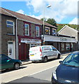
Launderette and van, Pontygwaith
A Pontygwaith Launderette collection & delivery van is parked in Llewellyn Street alongside Pontygwaith Launderette. A Costcutter store is on the right.
Image: © Jaggery
Taken: 19 Sep 2012
0.00 miles
2
Llewellyn St, Pontygwaith
Image: © John Lord
Taken: 6 Sep 2008
0.03 miles
3
Central section of Madeline Street, Pontygwaith
Looking north along Madeline Street past the right turn into an unnamed road to Llewellyn Street.
Image: © Jaggery
Taken: 8 Aug 2013
0.04 miles
4
Madeline Street, Pontygwaith
Viewed from the top end of an unnamed street that has ascended from Llewellyn Street.
Image: © Jaggery
Taken: 8 Aug 2013
0.04 miles
5
Pontygwaith Post Office
The post office is at 5 Llewellyn Street. On the left is the former Harmon chapel. http://www.geograph.org.uk/photo/3587595
Image: © Jaggery
Taken: 19 Sep 2012
0.04 miles
6
Hermon Flats, Pontygwaith
Viewed across Llewellyn Street. The flats are in the former Hermon chapel, erected in 1881.
Image: © Jaggery
Taken: 19 Sep 2012
0.04 miles
7
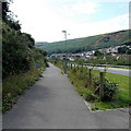
Cycle route 881 Pontygwaith
National Cycle Network route 881 heads south alongside the A4233 in Pontygwaith.
A nearby signpost http://www.geograph.org.uk/photo/3598881 shows that this is the way to Wattstown, Ynyshir and Porth.
Old maps show that this was the location of Tylorstown railway station, where passenger services ceased in 1964.
Image: © Jaggery
Taken: 8 Aug 2013
0.05 miles
8
Madeline Street,
Image: © Alex McGregor
Taken: 27 Jun 2012
0.06 miles
9
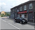
Pontygwaith Regeneration Partnership office
The office on the right is at 31 Llewellyn Street. Their website states that Pontygwaith Regeneration Partnership Ltd is responsible for the delivery of the Communities First programme locally and is a contact point for all things Communities First. The Partnership is working to regenerate the communities of Pontygwaith and Stanleytown through ongoing community development projects and activities.
Image: © Jaggery
Taken: 20 Aug 2013
0.06 miles
10
Cinnamon Spice, Pontygwaith
Indian and Bangladeshi cuisine restaurant at 2 Llewellyn Street.
Image: © Jaggery
Taken: 8 Aug 2013
0.06 miles


