IMAGES TAKEN NEAR TO
Middle Terrace, FERNDALE, CF43 3ET
Introduction
This page details the photographs taken nearby to Middle Terrace, CF43 3ET by members of the Geograph project.
The Geograph project started in 2005 with the aim of publishing, organising and preserving representative images for every square kilometre of Great Britain, Ireland and the Isle of Man.

There are currently over 7.5m images from over14,400 individuals and you can help contribute to the project by visiting https://www.geograph.org.uk
Image Map (Loading...)


Getting Data...Please wait
Leaflet Map data © OpenStreetMap
Images are licensed for reuse under creativecommons.org/licenses/by-sa/2.0
Notes
- Clicking on the map will re-center to the selected point.
- The higher the marker number, the further away the image location is from the centre of the postcode.
Image Listing (83 Images Found)
Images are licensed for reuse under creativecommons.org/licenses/by-sa/2.0
Image
Details
Distance
1
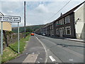
Football club this way, Stanleytown
The sign points along Middle Terrace.
Image: © Jaggery
Taken: 8 Aug 2013
0.01 miles
2
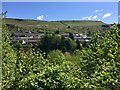
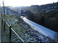
View of Stanleytown
View across the wooded valley of the Rhondda Fach towards Stanleytown.
Image: © Alan Hughes
Taken: 4 May 2019
0.01 miles
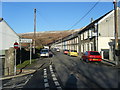
3

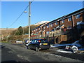
Lower Terrace, Stanleytown
Viewed from the corner of Middle Terrace.
Image: © Jaggery
Taken: 8 Aug 2013
0.03 miles
5
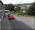
Lower Terrace junction, Stanleytown
Turn right here for the lane to the football ground.
Image: © Jaggery
Taken: 8 Aug 2013
0.03 miles
7
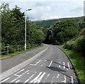
Lane to the football ground in Stanleytown
The unnamed lane descends from Lower Terrace http://www.geograph.org.uk/photo/3605655 towards the football ground
on the east bank of a river, the Rhondda Fach.
Image: © Jaggery
Taken: 8 Aug 2013
0.04 miles
9
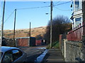
Middle Terrace, Stanleytown
Lock up garages at end of the terrace.
Image: © Colin Pyle
Taken: 4 Jan 2010
0.09 miles
10
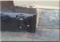
Ordnance Survey Pivot
This OS pivot can be found on the window sill of No1 Middle Terrace. It marks a point 188.400m above mean sea level.
Image: © Adrian Dust
Taken: 3 Mar 2021
0.09 miles