
IMAGES TAKEN NEAR TO
Gwernllwyn Terrace, FERNDALE, CF43 3DP
Introduction
This page details the photographs taken nearby to Gwernllwyn Terrace, CF43 3DP by members of the Geograph project.
The Geograph project started in 2005 with the aim of publishing, organising and preserving representative images for every square kilometre of Great Britain, Ireland and the Isle of Man.

There are currently over 7.5m images from over14,400 individuals and you can help contribute to the project by visiting https://www.geograph.org.uk
Image Map
Images are licensed for reuse under creativecommons.org/licenses/by-sa/2.0
Notes
- Clicking on the map will re-center to the selected point.
- The higher the marker number, the further away the image location is from the centre of the postcode.
Image Listing (37 Images Found)
Images are licensed for reuse under creativecommons.org/licenses/by-sa/2.0
Image
Details
Distance
2
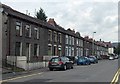
East Road houses, Tylorstown
A view from opposite a flight of steps http://www.geograph.org.uk/photo/3607932 looking along East Road towards the Duke of York. http://www.geograph.org.uk/photo/3589208
Image: © Jaggery
Taken: 8 Aug 2013
0.07 miles
3
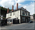
Duke of York, Tylorstown
Viewed across the A4233 East Road. The pub is on the corner of Union Place.
Image: © Jaggery
Taken: 8 Aug 2013
0.07 miles
4
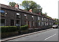
East Road houses, Tylorstown
Viewed across the A4233 East Road. There are no houses on the camera side of the road,
which is about 80 metres south of a river, the Rhondda Fach.
Image: © Jaggery
Taken: 8 Aug 2013
0.07 miles
5
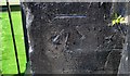
Ordnance Survey Cut Mark
This OS cut mark can be found on the Duke of York PH. It marks a point 216.198m above mean sea level.
Image: © Adrian Dust
Taken: 18 Jun 2017
0.08 miles
6
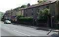
NW edge of residential Tylorstown
Viewed across the A4233 East Road. The house on the right is the last on this side of the road in Tylorstown. The next houses are in Oak Terrace, Ferndale, about 400 metres beyond the right edge of the view.
Image: © Jaggery
Taken: 8 Aug 2013
0.08 miles
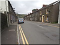
8
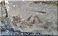
Ordnance Survey Cut Mark
This OS cut mark can be found on the wall of No144 East Road. It marks a point 217.707m above mean sea level.
Image: © Adrian Dust
Taken: 18 Jun 2017
0.09 miles
9
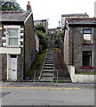
Steps from East Road to Hendrefadog Street, Tylorstown
The 50 metre flight of steps gives a short cut from the A4233 East Road to Hendrefadog Street.
Image: © Jaggery
Taken: 8 Aug 2013
0.10 miles
10
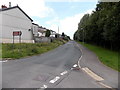
East Street NW of Prospect Place, Tylorstown
East Street heads NW towards the A4233 East Road junction, opposite the Duke of York. http://www.geograph.org.uk/photo/3589208
Image: © Jaggery
Taken: 20 Aug 2013
0.13 miles