
IMAGES TAKEN NEAR TO
East Road, FERNDALE, CF43 3DD
Introduction
This page details the photographs taken nearby to East Road, CF43 3DD by members of the Geograph project.
The Geograph project started in 2005 with the aim of publishing, organising and preserving representative images for every square kilometre of Great Britain, Ireland and the Isle of Man.

There are currently over 7.5m images from over14,400 individuals and you can help contribute to the project by visiting https://www.geograph.org.uk
Image Map
Images are licensed for reuse under creativecommons.org/licenses/by-sa/2.0
Notes
- Clicking on the map will re-center to the selected point.
- The higher the marker number, the further away the image location is from the centre of the postcode.
Image Listing (82 Images Found)
Images are licensed for reuse under creativecommons.org/licenses/by-sa/2.0
Image
Details
Distance
1
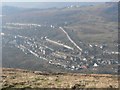
Tylorstown: view from above
A splendid view down the Rhondda valley above Tylorstown.
Image: © Chris Downer
Taken: 18 Feb 2008
0.00 miles
2
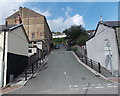
From Edmund Street to the Welfare Hall, Tylorstown
Steps on the left lead up from Edmund Street to the Welfare Hall. http://www.geograph.org.uk/photo/3612641
This is not a through route for vehicles because there is a metal barrier across the top of the road.
Image: © Jaggery
Taken: 20 Aug 2013
0.01 miles
3
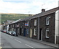
East Road houses, Tylorstown
Houses on the east side of East Road, viewed from near The Shot. http://www.geograph.org.uk/photo/3606025
Image: © Jaggery
Taken: 8 Aug 2013
0.01 miles
4
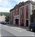
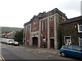
Welfare Hall Tylorstown
Viewed across East Road. Built as a Miners' Welfare Hall, now used by many local groups.
Users and usages include
• St John Ambulance
• Citizens Advice Bureau
• OAP Club
• Job Club
• Mothers and toddlers
• Community contact point
• Bingo
• Deaf Club meetings
• Snooker and Pool
Image: © Jaggery
Taken: 8 Aug 2013
0.01 miles
6
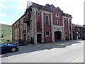
Welfare Hall viewed from the north, Tylorstown
Viewed across East Road. Built in 1933 as a Miners' Welfare Hall, now used by many local groups.
Users and usages in 2013 include:
• St John Ambulance
• Citizens Advice Bureau
• OAP Club
• Job Club
• Mothers and toddlers
• Community contact point
• Bingo
• Deaf Club meetings
• Snooker and Pool
Image: © Jaggery
Taken: 20 Aug 2013
0.02 miles
7
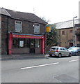
Mayfair Garden, Tylorstown
Fish & chips and Chinese cuisine takeaway at 204 East Road.
Image: © Jaggery
Taken: 8 Aug 2013
0.02 miles
8
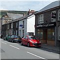
Devonalds solicitors, Tylorstown
The solicitors' office is in The Old Library, 217 East Road.
Image: © Jaggery
Taken: 8 Aug 2013
0.03 miles
9
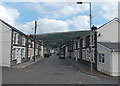
Central section of Edmund Street Tylorstown
Looking NNE from the corner of Park View.
Image: © Jaggery
Taken: 20 Aug 2013
0.05 miles
10
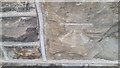
Ordnance Survey Cut Mark
This OS cut mark can be found on No7 Brynbedw Road. It marks a point 220.023m above mean sea level.
Image: © Adrian Dust
Taken: 24 Jun 2017
0.05 miles