
IMAGES TAKEN NEAR TO
Penrhys Road, FERNDALE, CF43 3BD
Introduction
This page details the photographs taken nearby to Penrhys Road, CF43 3BD by members of the Geograph project.
The Geograph project started in 2005 with the aim of publishing, organising and preserving representative images for every square kilometre of Great Britain, Ireland and the Isle of Man.

There are currently over 7.5m images from over14,400 individuals and you can help contribute to the project by visiting https://www.geograph.org.uk
Image Map
Images are licensed for reuse under creativecommons.org/licenses/by-sa/2.0
Notes
- Clicking on the map will re-center to the selected point.
- The higher the marker number, the further away the image location is from the centre of the postcode.
Image Listing (107 Images Found)
Images are licensed for reuse under creativecommons.org/licenses/by-sa/2.0
Image
Details
Distance
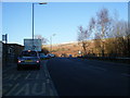
2
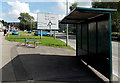
Shadowy bus shelter in Tylorstown
Located alongside the A4233 Pleasant View.
At the roundabout ahead, straight on for Ferndale, Maerdy and Aberdare, or turn left for Penrhys and locations in the Rhondda Fawr valley (this is the Rhondda Fach valley).
Image: © Jaggery
Taken: 20 Aug 2013
0.05 miles
3
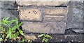
Ordnance Survey Cut Mark
This OS cut mark can be found on the wall west side of East Road. It marks a point 187.708m above mean sea level.
Image: © Adrian Dust
Taken: 24 Jun 2017
0.05 miles
4
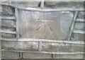
Ordnance Survey Cut Mark
This OS cut mark can be found on the wall of No16 Pleasant View. It marks a point 176.010m above mean sea level.
Image: © Adrian Dust
Taken: 3 Mar 2021
0.06 miles
5
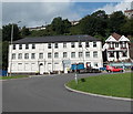
Former Diamond Jubilee Hotel, Tylorstown
Located on the west side of East Road, opposite a roundabout. Ground floor windows are protected by white boards. There is a For Sale notice on the left side of the building.
Image: © Jaggery
Taken: 20 Aug 2013
0.07 miles
6
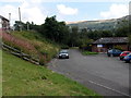
Tylorstown Clinic
Set below Ferndale Road, Tylorstown Clinic on the right is located near Sheppards Pharmacy. http://www.geograph.org.uk/photo/3610915
Image: © Jaggery
Taken: 20 Aug 2013
0.08 miles
7
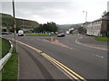
Roundabout at the junction of four 1km squares, Tylorstown
Image: © John Lord
Taken: 20 Jul 2016
0.08 miles
8
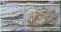
Ordnance Survey Cut Mark
This OS cut mark can be found on No19 Penrhys Road. It marks a point 206.472m above mean sea level.
Image: © Adrian Dust
Taken: 24 Jun 2017
0.08 miles
9
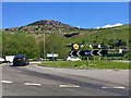
Roundabout on A4233
Approaching the roundabout from the Penrhys Road, with coal tips in the background.
Image: © Alan Hughes
Taken: 4 May 2019
0.08 miles
10
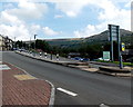
Pedestrian refuge, Ferndale Road, Tylorstown
Pedestrians crossing the A4233 Ferndale Road can wait in the central area when traffic is heavy.
A pharmacy http://www.geograph.org.uk/photo/3610915 and a clinic http://www.geograph.org.uk/photo/3610938 are on the opposite side of the road.
Image: © Jaggery
Taken: 20 Aug 2013
0.09 miles