IMAGES TAKEN NEAR TO
Park Road, TREORCHY, CF42 6LF

Introduction

This page details the photographs taken nearby to Park Road, CF42 6LF by members of the Geograph project.

The Geograph project started in 2005 with the aim of publishing, organising and preserving representative images for every square kilometre of Great Britain, Ireland and the Isle of Man.

There are currently over 7.5m images from over14,400 individuals and you can help contribute to the project by visiting https://www.geograph.org.uk

Image Map


Images are licensed for reuse under creativecommons.org/licenses/by-sa/2.0
Notes
  • Clicking on the map will re-center to the selected point.
  • The higher the marker number, the further away the image location is from the centre of the postcode.

Image Listing (42 Images Found)

Images are licensed for reuse under creativecommons.org/licenses/by-sa/2.0
  • ...
Image
Details
Distance
1
Individualistic house in Cwmparc
Standing out from the crowd in Park Road.
Image: © Jaggery Taken: 4 Apr 2014
0.03 miles
2
Tremains Hotel, Cwmparc
In April 2014, there were no name signs on this corner building near the western end of Park Road. Maps show it as the Tremains Hotel.
Image: © Jaggery Taken: 4 Apr 2014
0.04 miles
3
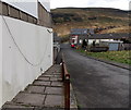
Steps down from Treharne Street, Cwmparc
Steps and a handrail are alongside the steepest part of the descent from Treharne Street to Park Road.
Image: © Jaggery Taken: 4 Apr 2014
0.04 miles
4
Ordnance Survey Cut Mark
This OS cut mark can be found on Tremains Hotel. It marks a point 213.378m above mean sea level.
Image: © Adrian Dust Taken: 28 Apr 2017
0.04 miles
5
Western end of Treharne Street, Cwmparc
This is the NW edge of residential Cwmparc, about 1.5km west of Treorchy.
Image: © Jaggery Taken: 4 Apr 2014
0.04 miles
6
Kissing gate, gate and notice, Cwmparc
Located between Park Road and Barrett Street. A Rhondda Cynon Taf notice shows NO TIPPING OR MOTORCYCLING. OFFENDERS WILL BE PROSECUTED.
Image: © Jaggery Taken: 4 Apr 2014
0.05 miles
7
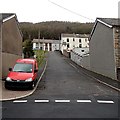
Side street in Cwmparc
Looking from Park Road past a Royal Mail van up an unnamed street towards Treharne Street.
Image: © Jaggery Taken: 4 Apr 2014
0.05 miles
8
Cwmparc and Treorchy
Looking down onto the Rhondda valley from Graig Fawr. The conical mound right of centre is the coal tip above Tylorstown which slipped in February 2020 bringing back memories of the Aberfan disaster.
Image: © Alan Hughes Taken: 27 Nov 2020
0.06 miles
9
Barrett Street, Cwmparc
Looking WSW from near the corner of Ocean Street.
Image: © Jaggery Taken: 4 Apr 2014
0.06 miles
10
The dead-end valley of Cwmparc
Housing comes to an abrupt end at the western end of Cwmparc near Treorchy. The valley of Cwmparc is enclosed by the horse-shoe shaped hills of Graig Fach and Graig Fawr. During WWII Cwmparc was unlucky enough to be bombed by the German Air Force. There were many casualties with some 27 dead, three of whom were evacuees, all members of the same family. The evacuees were all buried in the same grave in Treorchy Cemetery.
Image: © Alan Hughes Taken: 30 Oct 2017
0.07 miles
  • ...