1
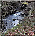
Houses at the SE end of Clare Road, Cwmparc
Looking towards the fence at the edge of a stream, Nant Cwm-parc.
Image: © Jaggery
Taken: 4 Apr 2014
0.02 miles
2
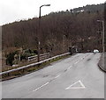
Clare Road, Cwmparc
From Lower Terrace along Clare Road towards the fence at the edge of a stream, Nant Cwm-parc.
Image: © Jaggery
Taken: 4 Apr 2014
0.02 miles
3
Junction of Park Crescent and Lower Terrace, Cwmparc
Looking across Park Crescent towards Lower Terrace.
Image: © Jaggery
Taken: 4 Apr 2014
0.03 miles
4
Mr Shine, Cwmparc
Hand car wash & valeting in Park Crescent.
Image: © Jaggery
Taken: 4 Apr 2014
0.03 miles
5
Cwmparc Convenience Store, Cwmparc
The Premier store is in Park Road, opposite the Chepstow Road junction. The building was originally the Co-operative Society's Cwmparc branch. The inscription remains at the top of the facade.
Image: © Jaggery
Taken: 4 Apr 2014
0.05 miles
6
Ordnance Survey Cut Mark
This OS cut mark can be found on the SW parapet of the railway Bridge. It marks a point 178.317m above mean sea level.
Image: © Adrian Dust
Taken: 28 Apr 2017
0.05 miles
7
Nant Cwm-parc issues from a culvert, Cwmparc
Viewed from Park Crescent. The culvert conveys the stream under the A4061.
Nant Cwm-parc is a tributary of the Rhondda Fawr river.
Image: © Jaggery
Taken: 4 Apr 2014
0.05 miles
8
Chepstow Road houses in Cwmparc
Looking NE towards Castle Street and Conway Road.
Image: © Jaggery
Taken: 4 Apr 2014
0.06 miles
9
Pen-twyn Road crosses over a stream in Cwmparc
The A4061 Pen-twyn Road crosses over Nant Cwm-parc ahead. Viewed from the corner of the A4061 Park Crescent, near the point where the course of this A road turns through nearly 90 degrees.
West of this point, Park Crescent is unclassified. A nearby sign points along Park Crescent for Cwmparc, and along this road for all other traffic.
Image: © Jaggery
Taken: 4 Apr 2014
0.06 miles
10
Junction of Conway Road and Chepstow Road, Cwmparc
Chepstow Road is on the left. A sign points right along Conway Road
towards Treorchy Comprehensive School, hence the 20mph speed limit.
Image: © Jaggery
Taken: 4 Apr 2014
0.06 miles


