
IMAGES TAKEN NEAR TO
Taff Street, TREORCHY, CF42 5LE
Introduction
This page details the photographs taken nearby to Taff Street, CF42 5LE by members of the Geograph project.
The Geograph project started in 2005 with the aim of publishing, organising and preserving representative images for every square kilometre of Great Britain, Ireland and the Isle of Man.

There are currently over 7.5m images from over14,400 individuals and you can help contribute to the project by visiting https://www.geograph.org.uk
Image Map
Images are licensed for reuse under creativecommons.org/licenses/by-sa/2.0
Notes
- Clicking on the map will re-center to the selected point.
- The higher the marker number, the further away the image location is from the centre of the postcode.
Image Listing (254 Images Found)
Images are licensed for reuse under creativecommons.org/licenses/by-sa/2.0
Image
Details
Distance
1
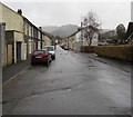
Taff Street, Treherbert
From Station Street along Taff Street towards Upper Taff Street.
Image: © Jaggery
Taken: 9 Nov 2017
0.01 miles
2
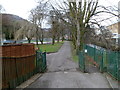
Path to Treherbert Park
This entrance to the park is from Station Street. Treherbert Park, also known as Jubilee Park, occupies a site on the SW bank of the Rhondda Fawr river. The river can be seen to the right of the green railings.
Image: © Jaggery
Taken: 23 Jan 2012
0.02 miles
3
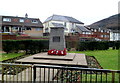
Treherbert and District War Memorial
The War Memorial is in Treherbert Park. It is dedicated
TO OUR GLORIOUS DEAD
WE WILL REMEMBER THEM
Image: © Jaggery
Taken: 23 Jan 2012
0.02 miles
4
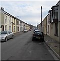
Upper Taff Street, Treherbert
Along Upper Taff Street towards Taff Street and Station Street.
Image: © Jaggery
Taken: 13 Nov 2017
0.02 miles
5
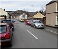
On-street parking, Taff Street, Treherbert
Viewed from the corner of Station Street.
Image: © Jaggery
Taken: 13 Nov 2017
0.02 miles
6
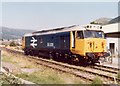
Class 50 at Treherbert
Locomotive 50031 Hood stands in the sidings to the north of Treherbert station, after arriving with a railtour.
Image: © Gareth James
Taken: Unknown
0.03 miles
7
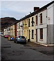
Row of houses, Taff Street, Treherbert
Extending for 90 metres from the corner of Park Close (on the right) to the edge of Upper Taff Street.
Image: © Jaggery
Taken: 13 Nov 2017
0.03 miles
8
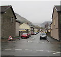
Taff Street, Treherbert
From Station Street along Taff Street towards Upper Taff Street.
Image: © Jaggery
Taken: 26 Oct 2017
0.03 miles
9
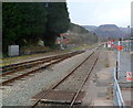
Stop sign at the Treherbert end of the Rhondda Line
Viewed from the edge of the platform at Treherbert station. At the edge of a level crossing, a stop sign with a large red spot marks the northern end of the Rhondda Line, about 37 km (23 miles) NW of Cardiff Central station.
In the distance is the distinctive shape of Pen Pych. http://www.geograph.org.uk/photo/1706600
Image: © Jaggery
Taken: 23 Jan 2012
0.05 miles
10
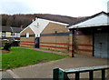
Treherbert Swimming Pool
The swimming pool building, located in the SE corner of Treherbert Park, closed in 2009.
There is currently (early 2012) an ongoing campaign by locals to reopen the facility.
Image: © Jaggery
Taken: 23 Jan 2012
0.05 miles