IMAGES TAKEN NEAR TO
Morris Street, TREORCHY, CF42 5HN

Introduction

This page details the photographs taken nearby to Morris Street, CF42 5HN by members of the Geograph project.

The Geograph project started in 2005 with the aim of publishing, organising and preserving representative images for every square kilometre of Great Britain, Ireland and the Isle of Man.

There are currently over 7.5m images from over14,400 individuals and you can help contribute to the project by visiting https://www.geograph.org.uk

Image Map


Images are licensed for reuse under creativecommons.org/licenses/by-sa/2.0
Notes
  • Clicking on the map will re-center to the selected point.
  • The higher the marker number, the further away the image location is from the centre of the postcode.

Image Listing (92 Images Found)

Images are licensed for reuse under creativecommons.org/licenses/by-sa/2.0
  • ...
Image
Details
Distance
1
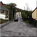
John St, from the corner of Ynysfeio Ave, Pen-yr-englyn, Treherbert
Image: © John Lord Taken: 10 Sep 2008
0.01 miles
2
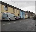
Royal Mail van, John Street, Treherbert
The red van is parked in John Street while its driver delivers letters and small parcels to nearby houses.
Image: © Jaggery Taken: 9 Nov 2017
0.01 miles
3
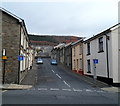
John Street, Treherbert
John Street ascends towards the Charles Street junction.
Image: © Jaggery Taken: 9 Nov 2017
0.02 miles
4
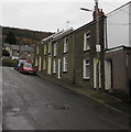
"Split-level" street, Hopkin St, Pen-yr-englyn, Treherbert
Image: © John Lord Taken: 10 Sep 2008
0.02 miles
5
Prince's Street, Treherbert
Dead end Prince's Street extends for 55 metres from the A4061 Baglan Street to a stone wall at the edge of Hopkin Street.
Image: © Jaggery Taken: 9 Nov 2017
0.02 miles
6
Hopkin Street, Treherbert
Looking SE along Hopkin Street from the corner of Mary Street.
Image: © Jaggery Taken: 9 Nov 2017
0.02 miles
7
Prince's Street, Pen-yr-englyn
Prince's Street is a cul-de-sac, viewed from the Baglan Street end. At the far end of Prince's Street are a wall and railings along the edge of Hopkin Street.
Image: © Jaggery Taken: 23 Jan 2012
0.03 miles
8
Row of houses, Mary Street, Treherbert
From Baglan Street, Mary Street ascends towards the junction with John Street, Hopkin Street and Mount Libanus Street.
Image: © Jaggery Taken: 9 Nov 2017
0.03 miles
9
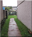
Path from Mary Street towards an electricity substation, Treherbert
The Western Power Distribution electricity substation is set back 20 metres from Mary Street.
Image: © Jaggery Taken: 9 Nov 2017
0.04 miles
10
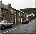
Mary Street houses, Treherbert
Viewed from the corner of Baglan Street.
Image: © Jaggery Taken: 9 Nov 2017
0.05 miles
  • ...