
IMAGES TAKEN NEAR TO
Margaret Street, PENTRE, CF41 7DA
Introduction
This page details the photographs taken nearby to Margaret Street, CF41 7DA by members of the Geograph project.
The Geograph project started in 2005 with the aim of publishing, organising and preserving representative images for every square kilometre of Great Britain, Ireland and the Isle of Man.

There are currently over 7.5m images from over14,400 individuals and you can help contribute to the project by visiting https://www.geograph.org.uk
Image Map
Images are licensed for reuse under creativecommons.org/licenses/by-sa/2.0
Notes
- Clicking on the map will re-center to the selected point.
- The higher the marker number, the further away the image location is from the centre of the postcode.
Image Listing (23 Images Found)
Images are licensed for reuse under creativecommons.org/licenses/by-sa/2.0
Image
Details
Distance
1
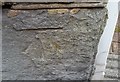
Ordnance Survey Cut Mark
This OS cut mark can be found on No8 Margaret Street. It marks a point 178.957m above mean sea level.
Image: © Adrian Dust
Taken: 7 May 2017
0.02 miles
2
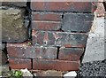
Ordnance Survey Cut Mark
This OS cut mark can be found on No1 Firgrove Street. It marks a point 176.037m above mean sea level.
Image: © Adrian Dust
Taken: 7 May 2017
0.05 miles
3
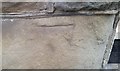
Ordnance Survey Cut Mark
This worn OS cut mark can be found on No127 Llewellyn Street. It marks a point 164.757m above mean sea level.
Image: © Adrian Dust
Taken: 7 May 2017
0.05 miles
4
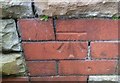
Ordnance Survey Cut Mark
This OS cut mark can be found on the SE face of the school. It marks a point 180.103m above mean sea level.
Image: © Adrian Dust
Taken: 7 May 2017
0.07 miles
5
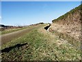
Water course
Most land that has been reclaimed from mining activity has large areas of coal slag below. Lessons were learned for the Aberfan disaster and for this reason watercourses are built into the land to ensure water is drained from the land.
Image: © Derek Cummings
Taken: 14 Feb 2010
0.09 miles
6
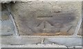
Ordnance Survey Cut Mark
This OS cut mark can be found on The Griffin PH. It marks a point 157.109m above mean sea level.
Image: © Adrian Dust
Taken: 7 May 2017
0.11 miles
8
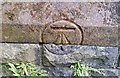
Ordnance Survey Cut Mark
This OS cut mark can be found on St Peter's Church. It marks a point 170.989m above mean sea level.
Image: © Adrian Dust
Taken: 7 May 2017
0.12 miles
9
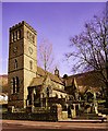
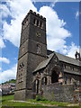
St Peters Church, Pentre, Rhondda Fawr Valley, South Wales
Built in 1890 at the height of the coal boom time in the Rhondda Valley.
St Peter's has a magnificent peal of 8 bells with the tenor a heavy 1,366kg.
The tower is over 100ft high.
Image: © Peter Brabham
Taken: 1 Nov 1998
0.12 miles
10
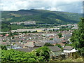
Pentre looking towards Treorchi
This is the beautiful view from Catherine Street across Pentre towards Treorchi
Image: © Nick Mutton 01329 000000
Taken: 8 Jul 2007
0.13 miles