1
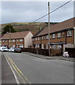
Two rows of houses, Bryn Ivor Street, Llwynypia
Bryn Ivor Street is a dead end street extending for nearly 300 metres from the A4058 Salem Terrace.
Image: © Jaggery
Taken: 2 Oct 2017
0.02 miles
2
Row of houses, Bryn Ivor Street, Llwynypia
On the west side of the main north-south alignment of Bryn Ivor Street.
Image: © Jaggery
Taken: 2 Oct 2017
0.02 miles
3
Rhondda Fawr river upstream from Princess Louise Road, Llwynypia
The Rhondda Fawr flows towards the bridge carrying the A4058, here named Princess Louise Road, over the river. On the right is an edge of a new hospital, Ysbyty Cwm Rhondda. http://www.geograph.org.uk/photo/2791402
Image: © Jaggery
Taken: 28 Oct 2011
0.03 miles
4
Bryn Ivor, Bryn Ivor Street, Llwynypia
Bryn Ivor is extra care housing for the elderly.
Image: © Jaggery
Taken: 2 Oct 2017
0.03 miles
5
Row of houses above Bryn Ivor Street, Llwynypia
Bryn Ivor Street is a dead end street extending for nearly 300 metres from the A4058 Salem Terrace.
Image: © Jaggery
Taken: 2 Oct 2017
0.04 miles
6
Oakfield Terrace, Llwynypia
Viewed across the A4058, which is named Salem Terrace to the left of Oakfield Terrace and Princess Louise Road to the right.
Image: © Jaggery
Taken: 28 Oct 2011
0.04 miles
7
Ty Tyrol, Llwynypia
The distinctive Tyrolean-style bungalow, with small red heart-shaped decorative patterns on the walls, is located between the A4058 and the Rhondda Fawr river.
Image: © Jaggery
Taken: 28 Oct 2011
0.04 miles
8
Bend in Bryn Ivor Street, Llwynypia
Bryn Ivor Street is a dead end street extending for nearly 300 metres from the A4058 Salem Terrace.
Image: © Jaggery
Taken: 2 Oct 2017
0.05 miles
9
Rhondda Line north from Llwynypia railway station
Towards Ystrad Rhondda station, 1 mile (1.6km) ahead.
Image: © Jaggery
Taken: 30 Mar 2015
0.05 miles
10
Rhondda Line heads north away from Llwynypia station
Viewed from the northern edge of the station platform. The next station is this direction is Ystrad Rhondda.
Image: © Jaggery
Taken: 28 Oct 2011
0.05 miles


