1
Ordnance Survey Cut Mark
This OS cut mark can be found on the wall west side of the road. It marks a point 144.390m above mean sea level.
Image: © Adrian Dust
Taken: 27 May 2018
0.02 miles
2
Rhondda Line heads north away from Llwynypia station
Viewed from the northern edge of the station platform. The next station is this direction is Ystrad Rhondda.
Image: © Jaggery
Taken: 28 Oct 2011
0.08 miles
3
Rhondda Line north from Llwynypia railway station
Towards Ystrad Rhondda station, 1 mile (1.6km) ahead.
Image: © Jaggery
Taken: 30 Mar 2015
0.08 miles
4
Ordnance Survey Cut Mark
This OS cut mark can be found on the wall east side of the road. It marks a point 144.439m above mean sea level.
Image: © Adrian Dust
Taken: 27 May 2018
0.09 miles
5
Llwynypia viewed from Penrhys Road, Ystrad
Llwynypia is built on flattish land in the valley of the Rhondda Fawr river.
The grey river between trees can be seen near the centre of the view.
Image: © Jaggery
Taken: 30 Mar 2015
0.11 miles
6
Rhondda Fawr river upstream from Princess Louise Road, Llwynypia
The Rhondda Fawr flows towards the bridge carrying the A4058, here named Princess Louise Road, over the river. On the right is an edge of a new hospital, Ysbyty Cwm Rhondda. http://www.geograph.org.uk/photo/2791402
Image: © Jaggery
Taken: 28 Oct 2011
0.11 miles
7
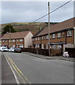
Row of houses, Bryn Ivor Street, Llwynypia
On the west side of the main north-south alignment of Bryn Ivor Street.
Image: © Jaggery
Taken: 2 Oct 2017
0.11 miles
8
Two rows of houses, Bryn Ivor Street, Llwynypia
Bryn Ivor Street is a dead end street extending for nearly 300 metres from the A4058 Salem Terrace.
Image: © Jaggery
Taken: 2 Oct 2017
0.11 miles
9
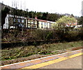
Taff Cottages, Llwynypia
From Llwynypia railway station.
Image: © Jaggery
Taken: 30 Mar 2015
0.14 miles
10
Bryn Ivor, Bryn Ivor Street, Llwynypia
Bryn Ivor is extra care housing for the elderly.
Image: © Jaggery
Taken: 2 Oct 2017
0.14 miles


