
IMAGES TAKEN NEAR TO
Howard Street, TONYPANDY, CF40 2BW
Introduction
This page details the photographs taken nearby to Howard Street, CF40 2BW by members of the Geograph project.
The Geograph project started in 2005 with the aim of publishing, organising and preserving representative images for every square kilometre of Great Britain, Ireland and the Isle of Man.

There are currently over 7.5m images from over14,400 individuals and you can help contribute to the project by visiting https://www.geograph.org.uk
Image Map
Images are licensed for reuse under creativecommons.org/licenses/by-sa/2.0
Notes
- Clicking on the map will re-center to the selected point.
- The higher the marker number, the further away the image location is from the centre of the postcode.
Image Listing (53 Images Found)
Images are licensed for reuse under creativecommons.org/licenses/by-sa/2.0
Image
Details
Distance
1
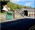
Howard Street bus stop and shelter, Clydach Vale
This stop near the corner of Marian Street is for buses to Tonypandy.
The Clydach Vale pub http://www.geograph.org.uk/photo/5560862 is on the right.
Image: © Jaggery
Taken: 5 Oct 2017
0.01 miles
2
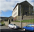
East side of the former Zoar chapel, Clydach Vale
The building is now Zoar Residential Home, http://www.geograph.org.uk/photo/5560866 much altered from when it was Zoar chapel, though this side of the building appears largely unaltered. A tablet http://www.geograph.org.uk/photo/5560883 records that the chapel was built in 1881.
Image: © Jaggery
Taken: 5 Oct 2017
0.02 miles
3
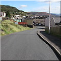
Descent towards High Street, Clydach Vale
From Howard Street.
Image: © Jaggery
Taken: 5 Oct 2017
0.02 miles
4
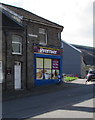
Cambrian Stores, 61 Wern Street, Clydach Vale
In October 2017 the Premier convenience store is open
from 7am-9pm every day except Sunday when it's 8am-8pm.
Image: © Jaggery
Taken: 5 Oct 2017
0.02 miles
5
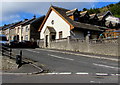
Up Marian Street, Clydach Vale
Marian Street ascends from the crossroads where Wern Street, Howard Street and Morton Terrace also meet.
Image: © Jaggery
Taken: 5 Oct 2017
0.02 miles
6
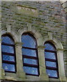
Zoar 1881 tablet, Clydach Vale
On the east side of the former Zoar chapel http://www.geograph.org.uk/photo/5560876 now converted to Zoar Residential Home. http://www.geograph.org.uk/photo/5560866
The Welsh text shows that Zoar was an Independent Chapel built in 1881.
I expected to see SOAR on the tablet as there is no Z in the standard Welsh alphabet.
Image: © Jaggery
Taken: 5 Oct 2017
0.02 miles
7
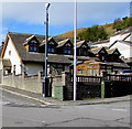
CCTV camera and telecoms cabinets on a Clydach Vale corner
A CCTV camera on a pole and a Virgin Media cabinet are on the Marian Street side of the corner.
A BT cabinet is on the Morton Terrace side.
Image: © Jaggery
Taken: 5 Oct 2017
0.02 miles
8
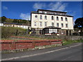
Zoar Residential Home, Clydach Vale
The Howard Street side of Zoar Residential Home on the corner of Marian Street.
The building is the much altered former Zoar chapel erected in 1881.
Image: © Jaggery
Taken: 5 Oct 2017
0.03 miles
9
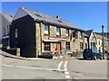
The Clydach Vale
Public house at the top of Wern Street, Cwm Clydach.
Image: © Alan Hughes
Taken: 11 Apr 2019
0.03 miles
10
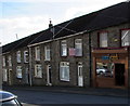
Good Food shop, 59 Wern Street, Clydach Vale
Viewed in October 2017. An August 2012 Google Earth Street View shows Siân's Fish Bar here.
Image: © Jaggery
Taken: 5 Oct 2017
0.03 miles