1
Brith-Weunydd above Trealaw
View across Trealaw and the Rhondda Fawr towards Brith-Weunydd and Mynydd Troed-y-Rhiw.
Image: © Alan Hughes
Taken: 6 Jul 2020
0.09 miles
2
A4058 Dinas Road
Image: © Colin Pyle
Taken: 9 Sep 2011
0.12 miles
3
Western boundary of Dinas (Rhondda)
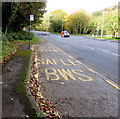
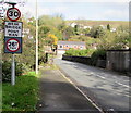
The A4058 Dinas Road from Tonypandy reaches the Dinas boundary. The 40mph speed limit drops to 30mph. Dinas means city in modern Welsh, but here it has the older meaning of hill fort.
Image: © Jaggery
Taken: 17 Oct 2017
0.13 miles
4
Railway Station bus stop, Dinas Road, Dinas
Alongside the A4058 Dinas Road near Dinas Rhondda railway station, this stop is for buses on route 130 to Tonypandy, Treorchy, Blaenrhondda (Tonypandy, Blaencwm, Blaenrhondda on Sundays).
Image: © Jaggery
Taken: 17 Oct 2017
0.13 miles
5
Station/Gorsaf this way, Dinas
An English sign and a Welsh sign point across the A4058 Dinas Road
towards Station Road for Dinas Rhondda railway station.
Image: © Jaggery
Taken: 17 Oct 2017
0.13 miles
6
Weak bridge near Dinas Rhondda railway station, Trealaw
A 26 tonnes mgw limit is in force over the bridge carrying Station Road over the Rhondda Line railway and the Rhondda River. mgw is maximum gross weight, the maximum legally permitted weight of a vehicle, including fuel, load, driver, passengers etc. Pont Wan is Welsh for Weak Bridge. The A4058 Dinas Road is in the background.
Image: © Jaggery
Taken: 28 Sep 2017
0.14 miles
7
Pedestrian refuge near Dinas
In the middle of the A4058 Dinas Road from Tonypandy. The Dinas boundary http://www.geograph.org.uk/photo/5572220 is ahead.
Image: © Jaggery
Taken: 17 Oct 2017
0.14 miles
8
Weak bridge/Pont wan, Station Road, Dinas
The English/Welsh sign facing the A4058 Dinas Road shows a 26 tonnes mgw limit across the bridge. mgw is maximum gross weight, the maximum legally permitted weight of a vehicle, including fuel, load, driver, passengers etc.
Image: © Jaggery
Taken: 17 Oct 2017
0.15 miles
9
Junction of Dinas Road and Station Road, Dinas
Ahead along Station Road then turn right for Dinas Rhondda railway station. http://www.geograph.org.uk/photo/5553164
Image: © Jaggery
Taken: 17 Oct 2017
0.15 miles
10
Mural, Flats, Dinas 2
See
Image for a wider view taken from the bridge.
Image: © Ivan Hall
Taken: 14 Oct 2010
0.15 miles


