1
Penygraig Surgery, Penygraig
Medical surgery at 47 George Street.
Image: © Jaggery
Taken: 20 Oct 2017
0.02 miles
2
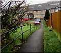
Path down from Penygraig Road, Penygraig
Descending to Balaclava Court.
Image: © Jaggery
Taken: 26 Oct 2017
0.02 miles
3
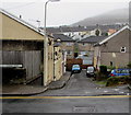
Balaclava Court, Penygraig
Managed by Rhondda Housing Association, Balaclava Court is retirement housing containing 44 flats built in 1991.
Image: © Jaggery
Taken: 26 Oct 2017
0.03 miles
4
Up Penygraig Road, Penygraig
The B4278 Penygraig Road ascends towards Tonyrefail 2½ miles away.
Image: © Jaggery
Taken: 20 Oct 2017
0.03 miles
5
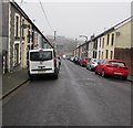
Down George Street, Penygraig
From Tynycai Place, George Street descends towards Balaclava Court.
Image: © Jaggery
Taken: 26 Oct 2017
0.03 miles
6
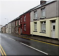
Penygraig Road houses, Penygraig
On the east side of the B4278 Penygraig Road southeast of Tonypandy.
Image: © Jaggery
Taken: 26 Oct 2017
0.03 miles
7
Well Pharmacy, George Street, Penygraig
On the corner of Balaclava Court. Penygraig Surgery http://www.geograph.org.uk/photo/5576120 is on the right.
Image: © Jaggery
Taken: 20 Oct 2017
0.03 miles
8
Benches alongside Penygraig Road, Penygraig
On the east side of the B4278 Penygraig Road. The railings are alongside a path descending to Balaclava Court.
Image: © Jaggery
Taken: 26 Oct 2017
0.03 miles
9
Labour Club bus stop and shelter, Penygraig
Alongside the B4278 Penygraig Road near Penygraig Labour Club. https://www.geograph.org.uk/photo/5575970 In October 2017, the bus stop sign shows four routes - 122 to Cardiff via Royal Glamorgan Hospital & Talbot Green, 152 to Tonyrefail, 153 to Gilfach Goch & Evanstown, 172 to Bridgend & Porthcawl.
Image: © Jaggery
Taken: 26 Oct 2017
0.04 miles
10
Cross Row, Penygraig
Short dead-end street below Penygraig Road.
Image: © Jaggery
Taken: 26 Oct 2017
0.04 miles


